Events coming up:
- Sustainable Living 2024 Sunday 23 June, 1:15-4pm @ The Round
- Blackburn Creeklands Working Bee: Sunday 7 July 09:00-12:00 – NAIDOC Week
- Blackburn Creeklands Working Bee: Sunday 28 July 09:00-12:00 – National Tree Day
40th Birthday of the Committee
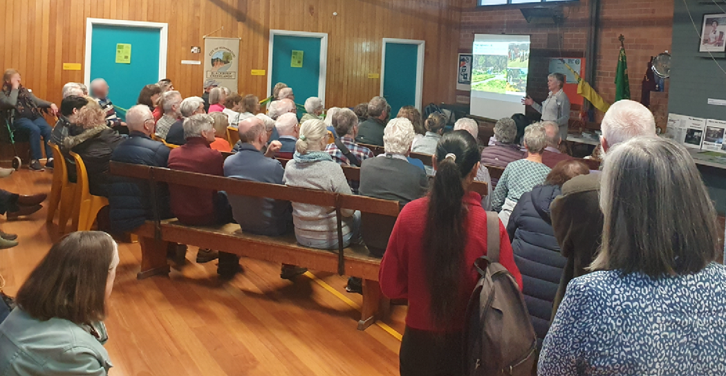
We were very pleased at the level of attendance at our Committee’s 40th birthday party. We sincerely thank the community for that excellent support. The function took the form of:
- A scrumptious afternoon tea allowing inspection of many photo-boards presenting our history
- Two brief talks – one covering the components of the park prior to their integration into the Creeklands – the other covering the formation of the Commitee following grassroots community action and the significant efforts and developments that ensued.
- The finale – which was the solution to the quiz based on photos taken in the Creeklands at various locations and points in time throughout the park. We were so impressed by the effort and observation people put in to solving the quiz – some questions were very tricky! The answers to the quiz are collected at the end of this newsletter.
Those who were present may have noticed the hasty rearrangement of the photo boards to create more seating room for the bench seats – we got double the expected number of attendees. A very nice problem to have indeed! It was also fantastic to have some of the veterans of the early days take the trouble to attend and fill in some of the gaps in our knowledge.
Another way to gauge the effort and the scale of the work done by community volunteers, Council and Melbourne Water (formerly the MMBW) over the years is to compare the park from the air in 1945 versus the current day. The tree line follows the meandering creek (that’s Middleborough Road going north-south on the left and Blackburn Road is the kinked one on the right):
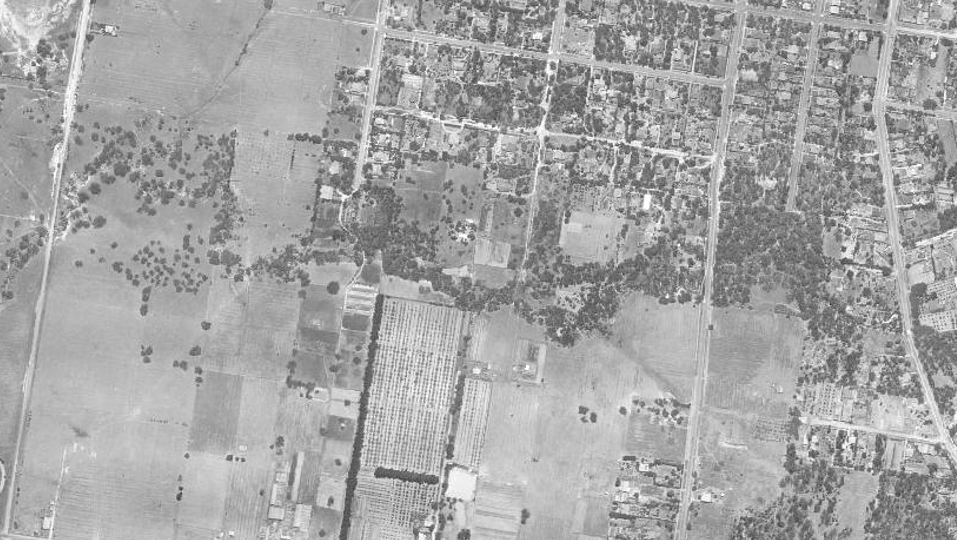
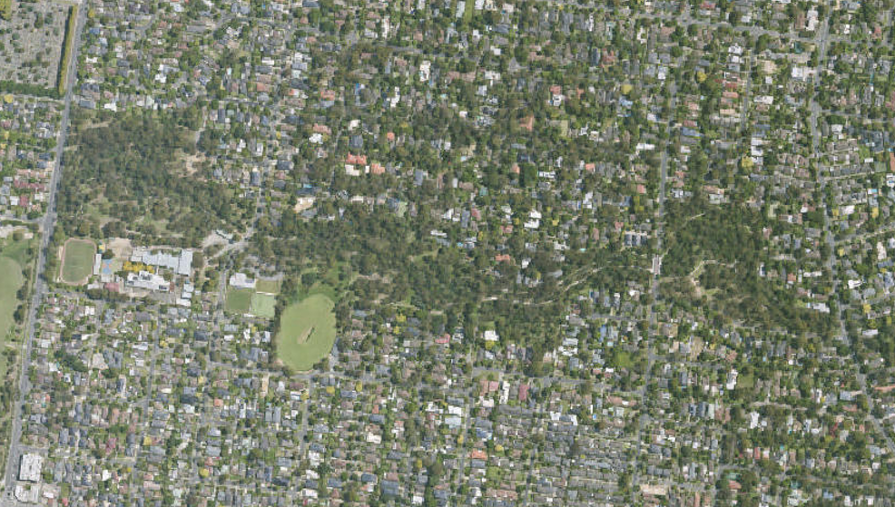
Clearly, tree canopy and other vegetation have improved significantly since WW2 despite the urbanisation of the area. One can also see the significant contributions to the canopy of private property in the area – particularly in the “bellbird area” north of the creek and towards Blackburn Lake to the east.
Sightings
Another New Bird Species !
After May’s regular monthly bird watching event conducted by experienced bird watchers, some were chatting in the carpark at Kalang Oval before leaving for the day. Suddenly, nearby Lorikeets became very alarmed – the birdos looked up in response to see a Whistling Kite (Haliastur spenurus) circling for a bit before heading off southwest towards Burwood.
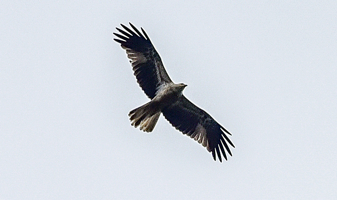
The Whistling Kite is a medium-sized raptor with “fingered” wings found throughout Australia and is named for its loud whistling call. The species is an opportunist hunter and scavenger which inhabits a wide range of open country mostly near water. They have a wide variety of prey including rabbits, birds and even fish plucked from the surface.
We are rapt (sorry!) that raptors seem to have taken to surveilling our park. Last year, we saw a Nankeen Kestrel and, in 2022, a Black-shouldered Kite and a Wedge-tailed Eagle – all for the first time. One wonders whether these birds have always been around – and that it’s due the skills of our bird-watchers and today’s quality equipment that we are now spotting and identifying them.
In other bird photographs for the month, we have:
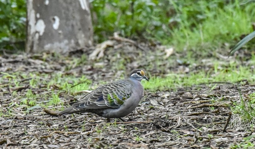
- A male common bronzewing – the yellowish patch on his forehead gives away his sex.
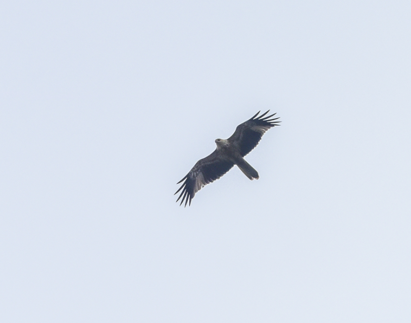
- Another shot of the Whistling Kite.
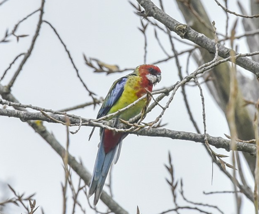
- An Eastern Rosella – the species is relatively common at the moment – they are enjoying flowers such as the Correas.
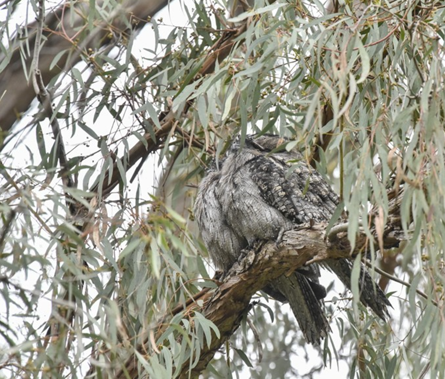
- A pair of Tawny Frogmouths huddling for warmth.
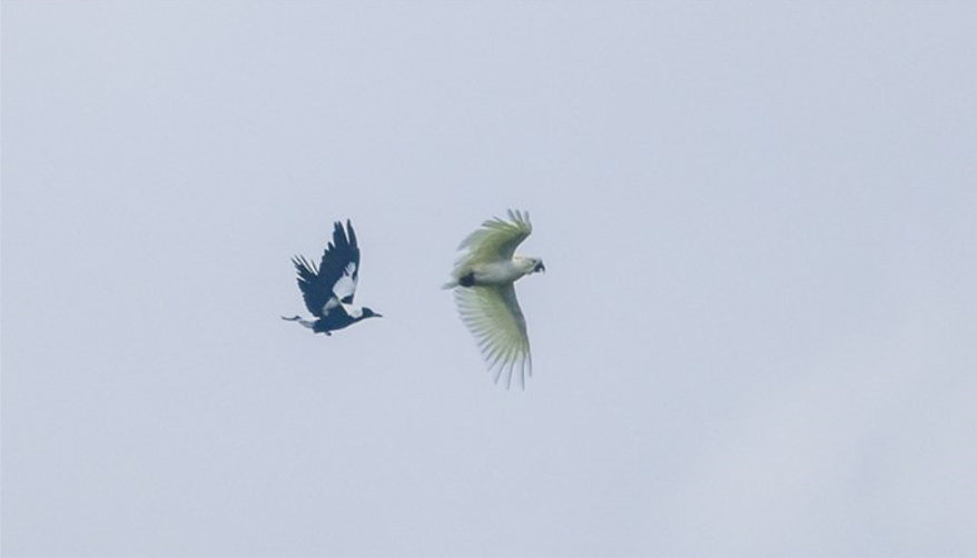
- An odd shot in which a Magpie seems to be chasing a Sulphur-crested Cockatoo away.
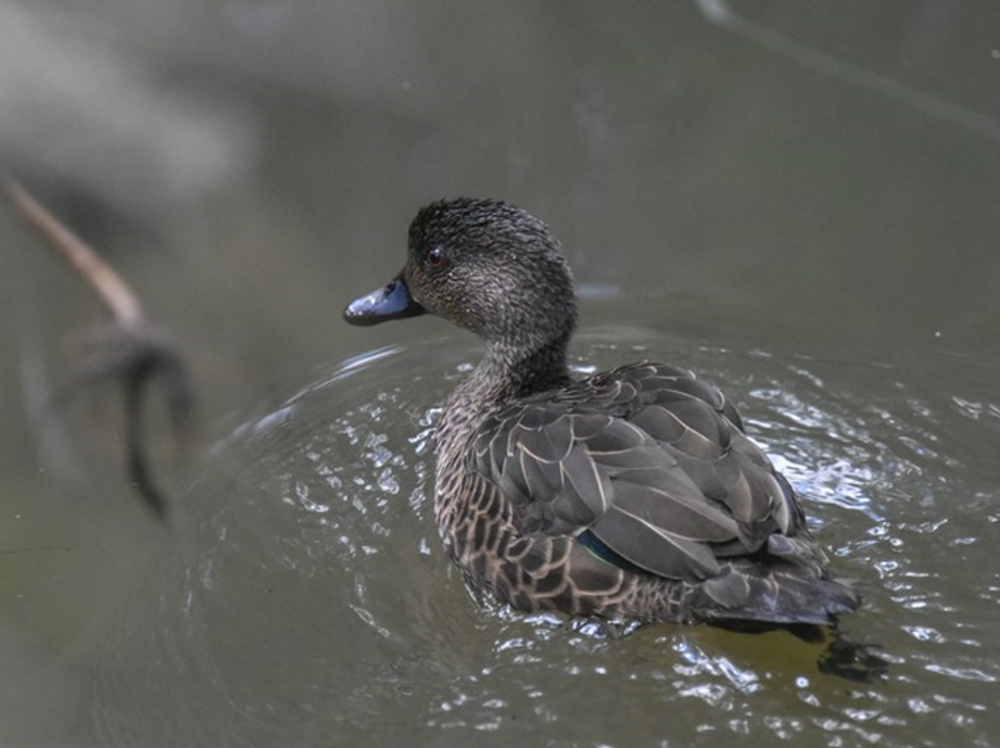
- A Chestnut Teal – hard to say whether non-breeding male, female or ageing juvenile – though we do bear in mind that the elected Teals are all females.
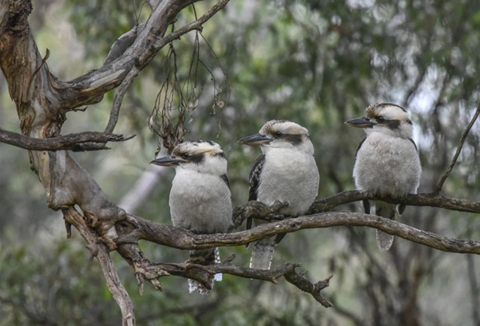
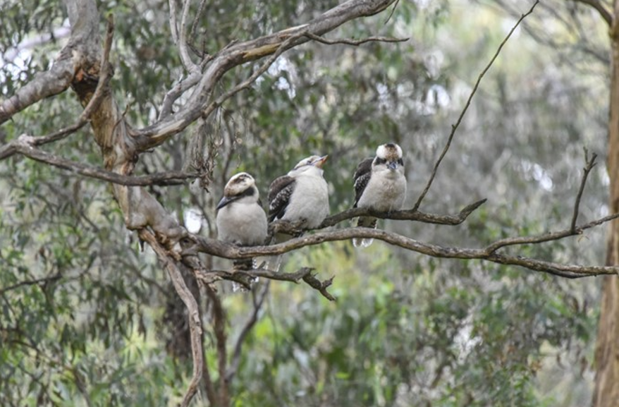
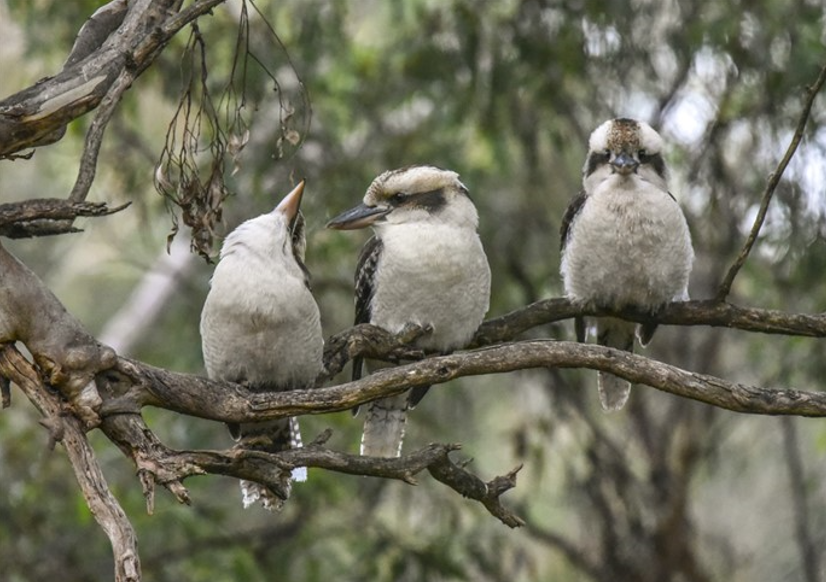
- Whilst on a political bent, a comical party of right-wing leaning, branch-stacking kookaburras in which unity of direction swiftly collapses!
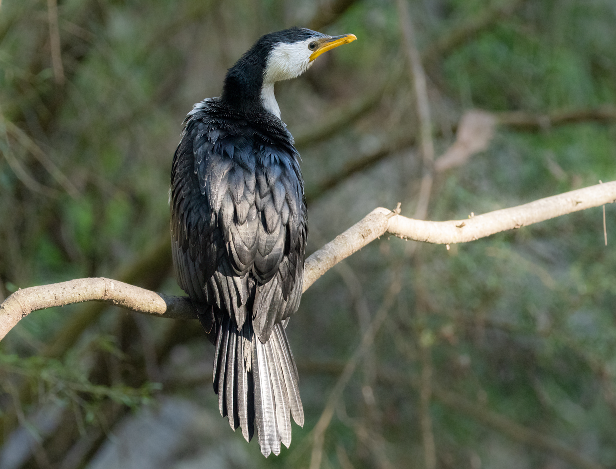
- Finally, a Little Pied Cormorant (affectionately known as “Cory”) at the Laurel Grove Bridge last week.
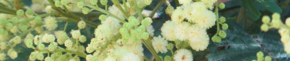
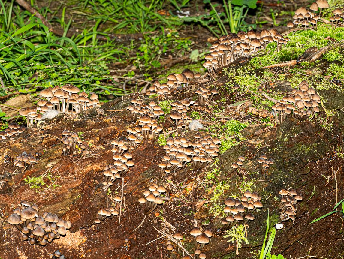
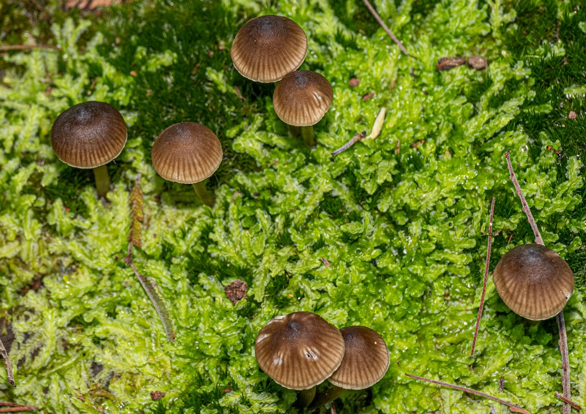
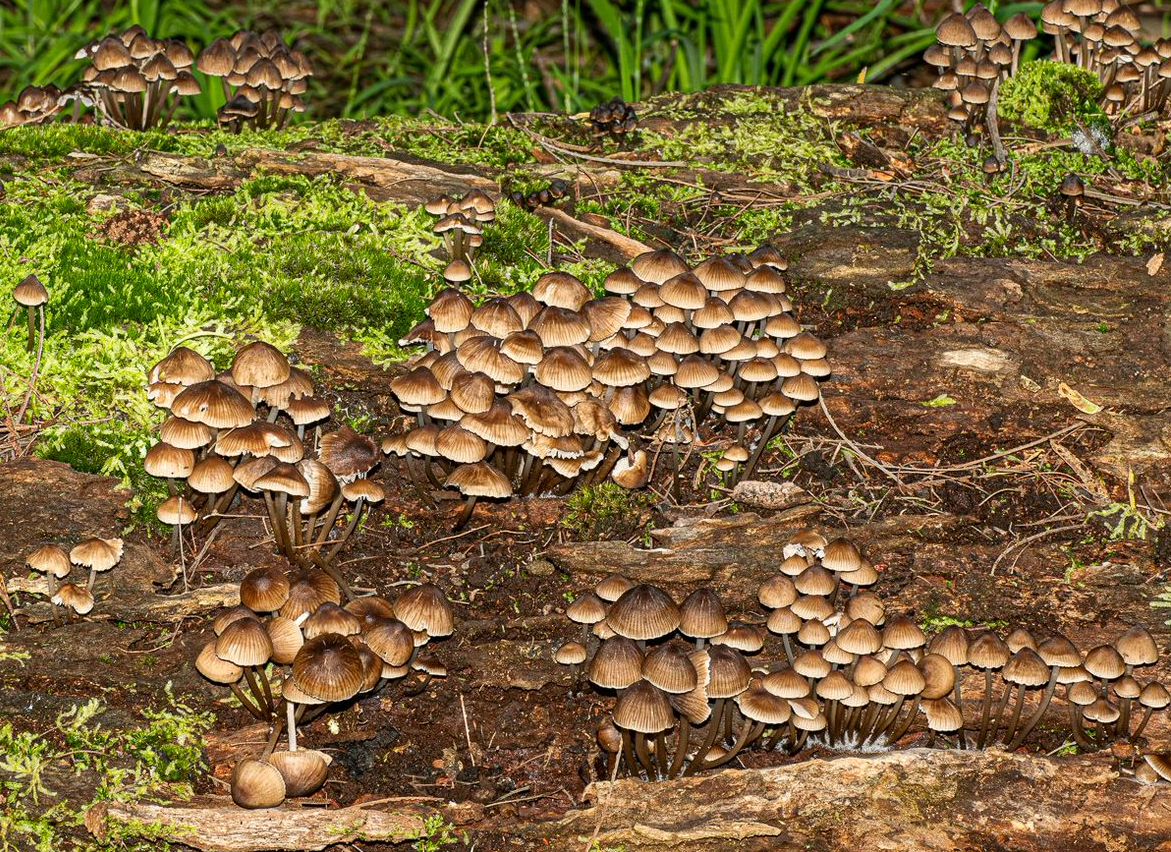
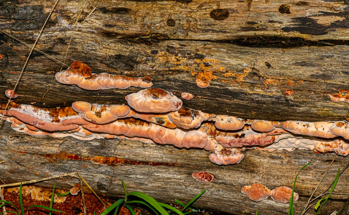
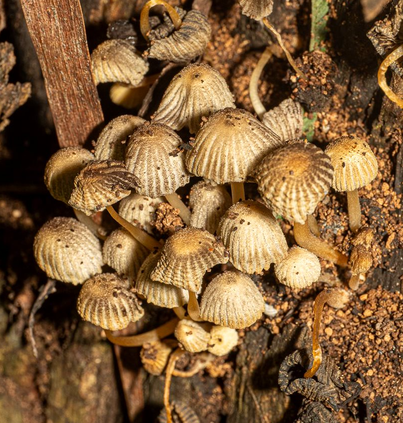
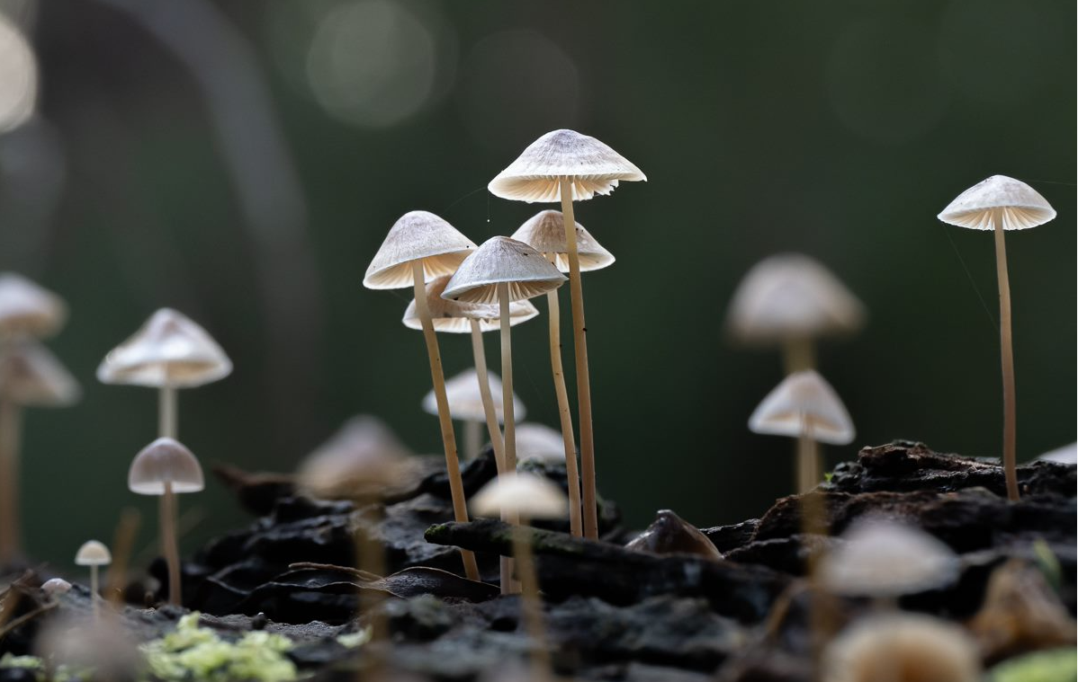
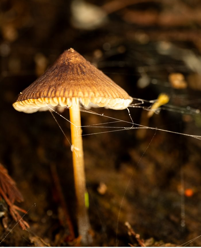
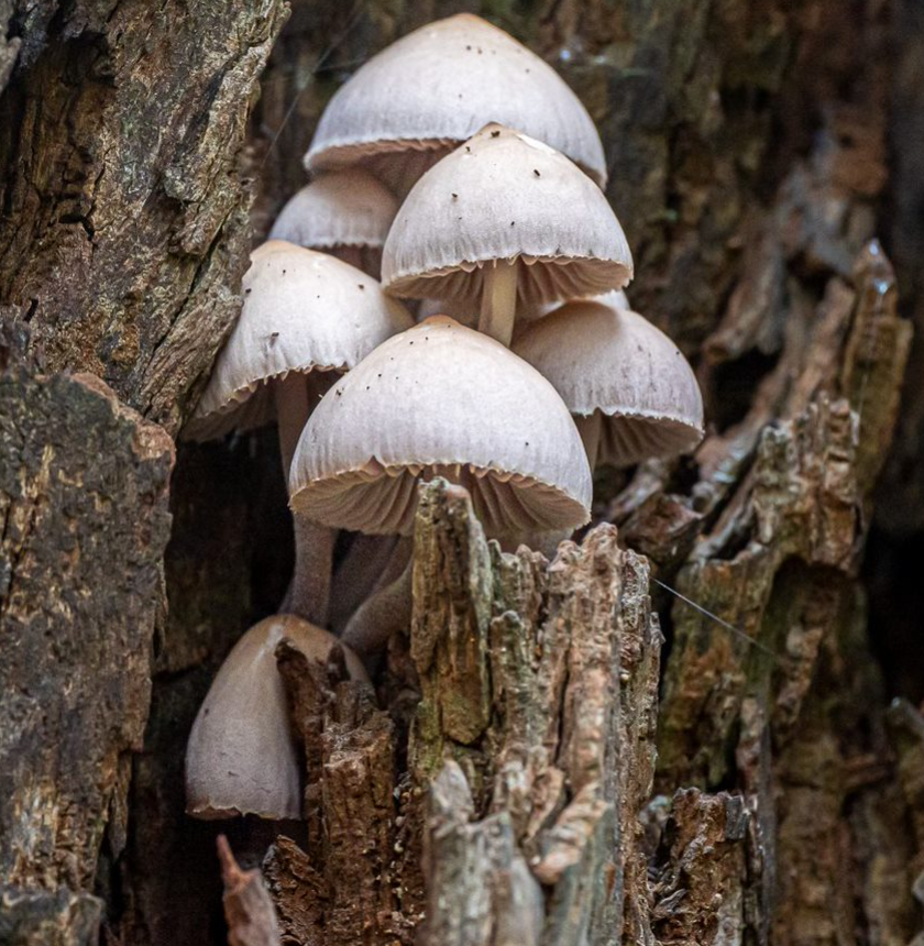
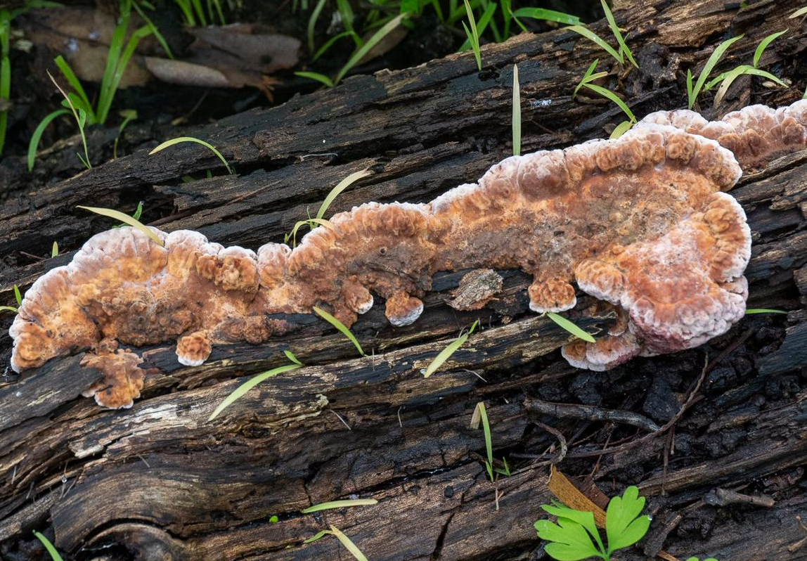
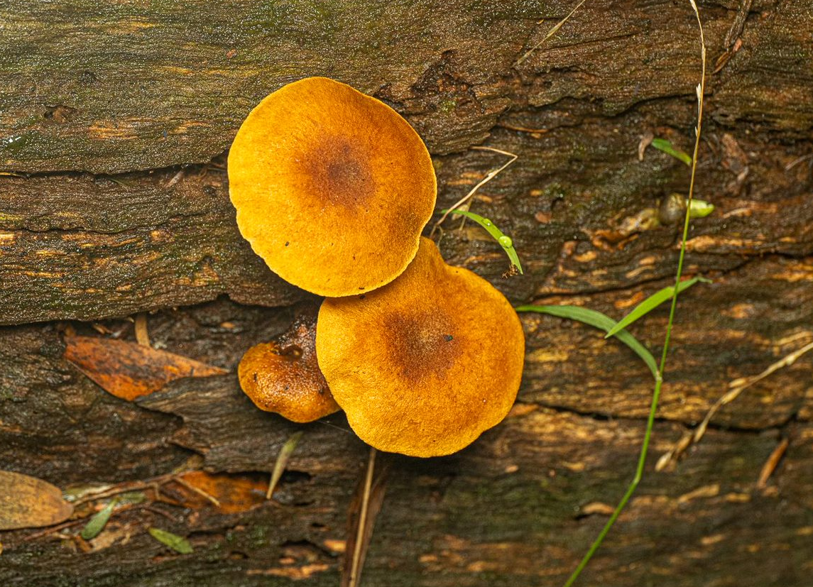
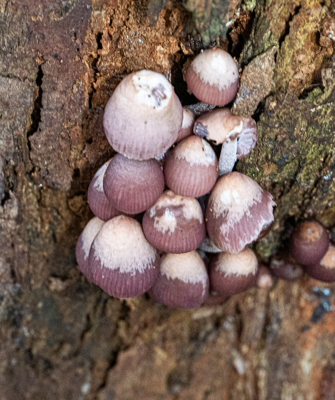
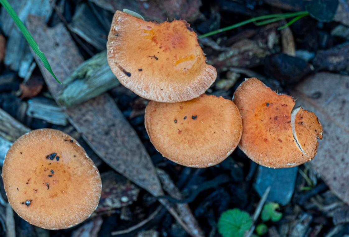
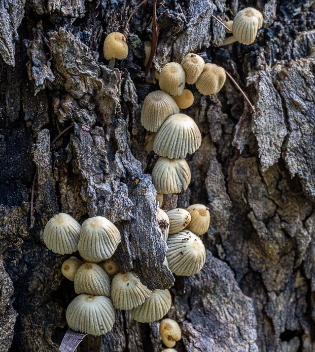
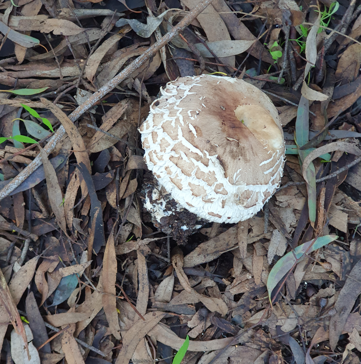
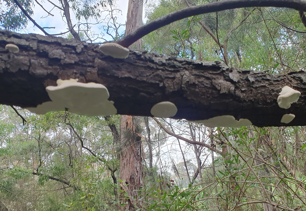
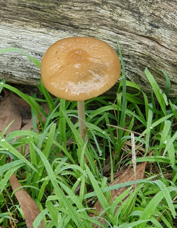
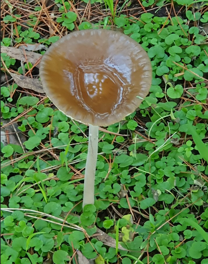
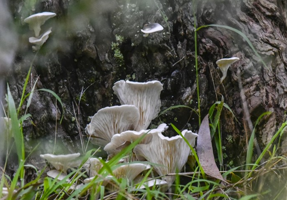
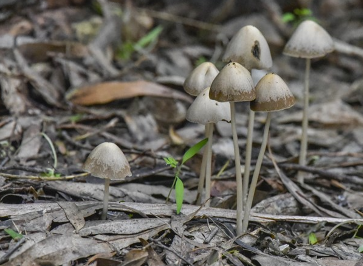
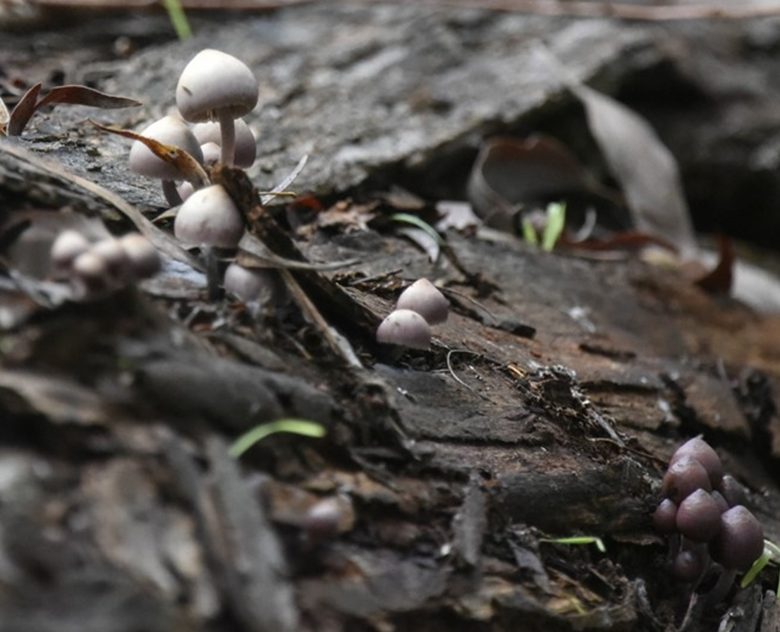
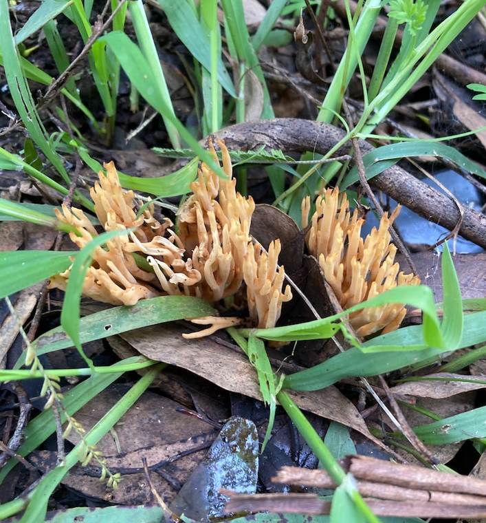
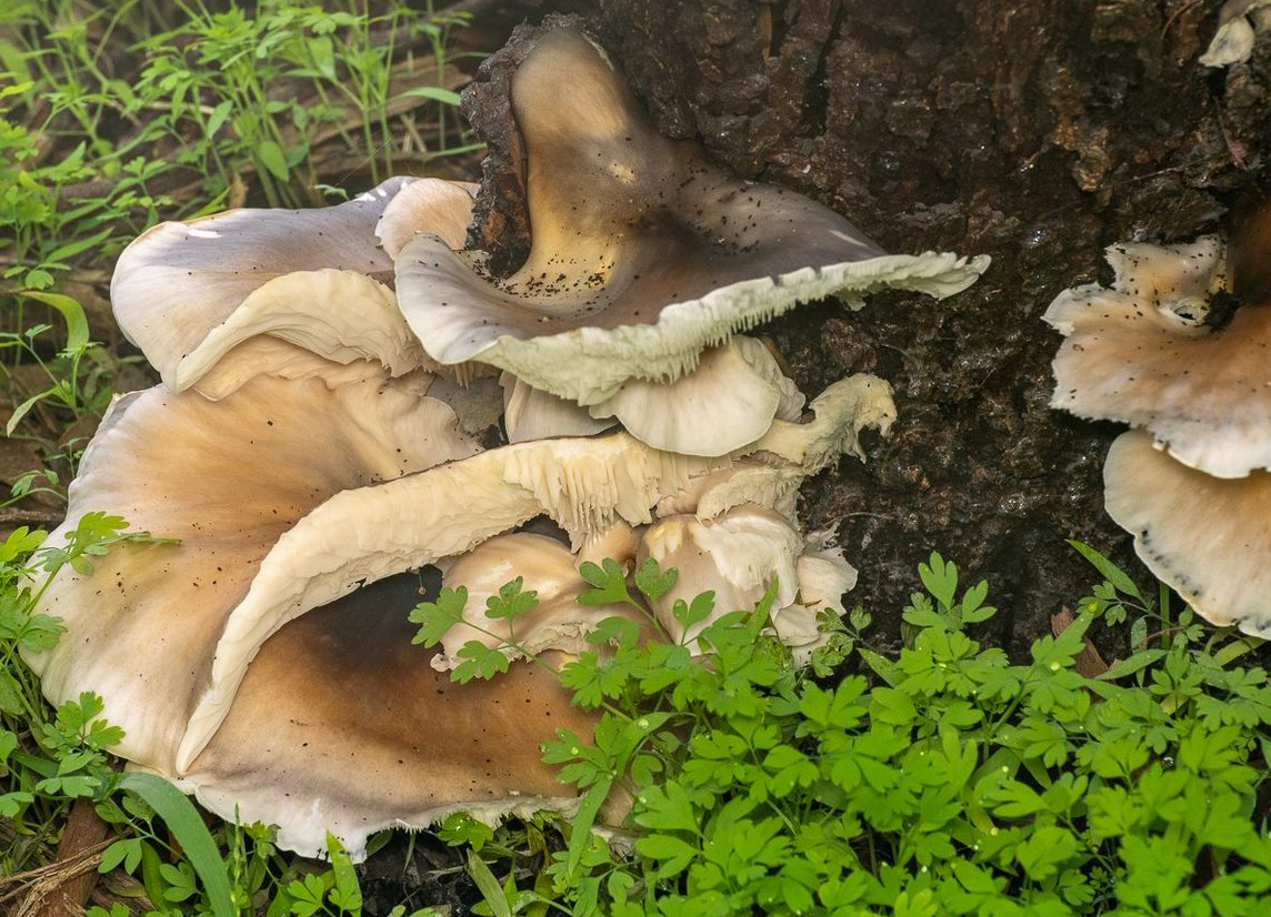
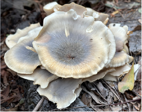
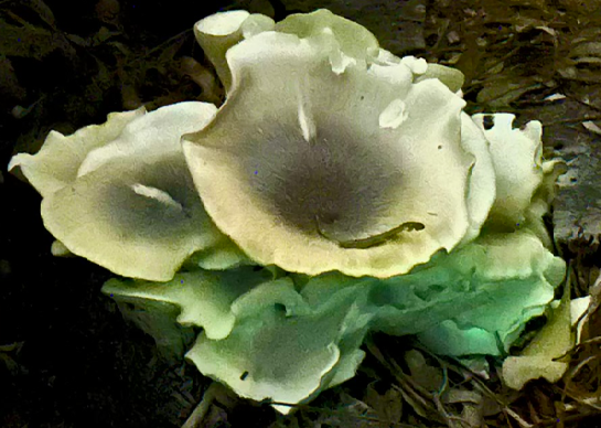
Fungi
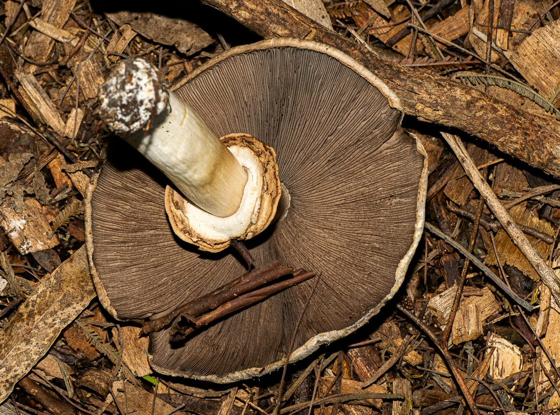
May has been an amazing month for fungi! For about the first 20 shots, Ken was out and about on two days (in Kalang and in Furness respectively) with a macro lens mounted on his camera. The remainder are by several other locals using a variety of equipment…
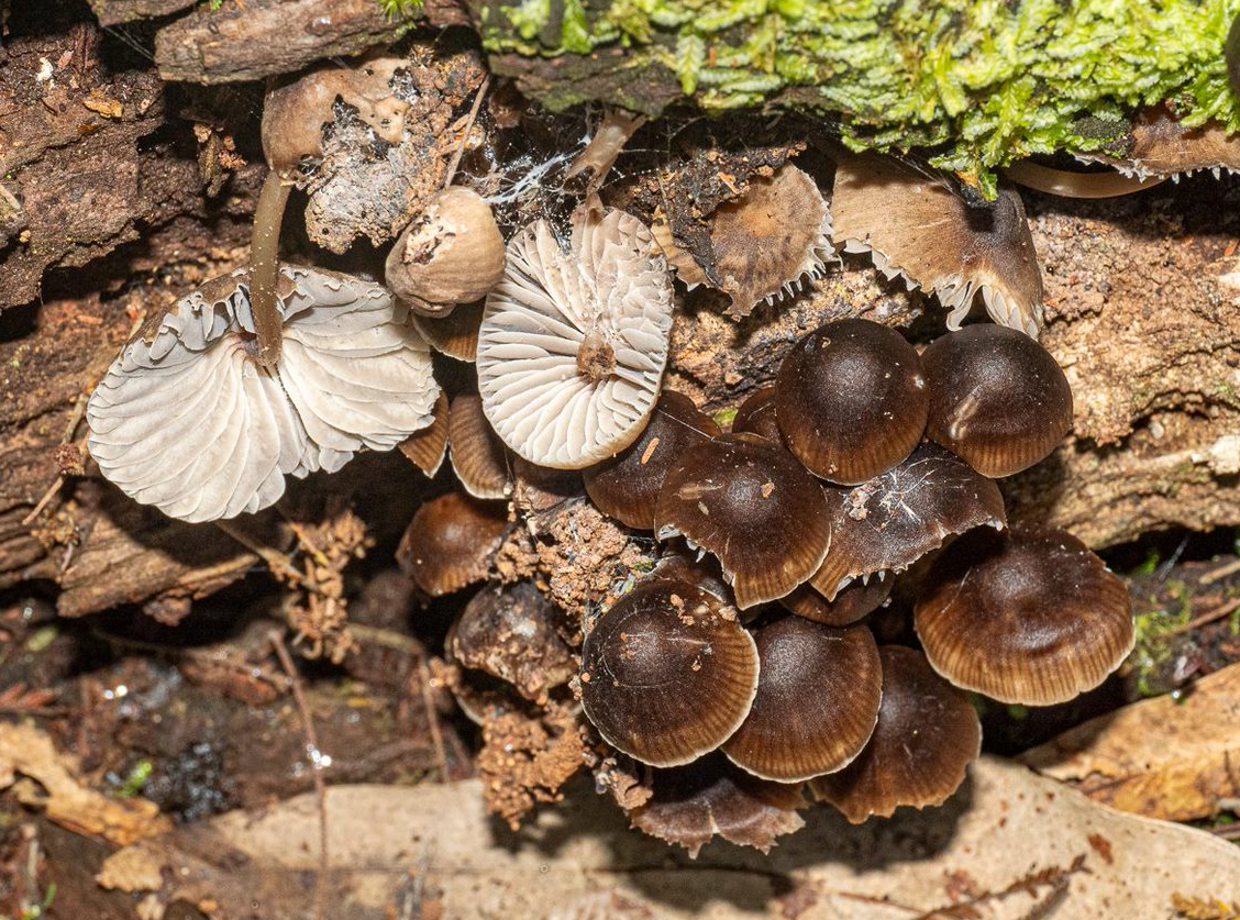
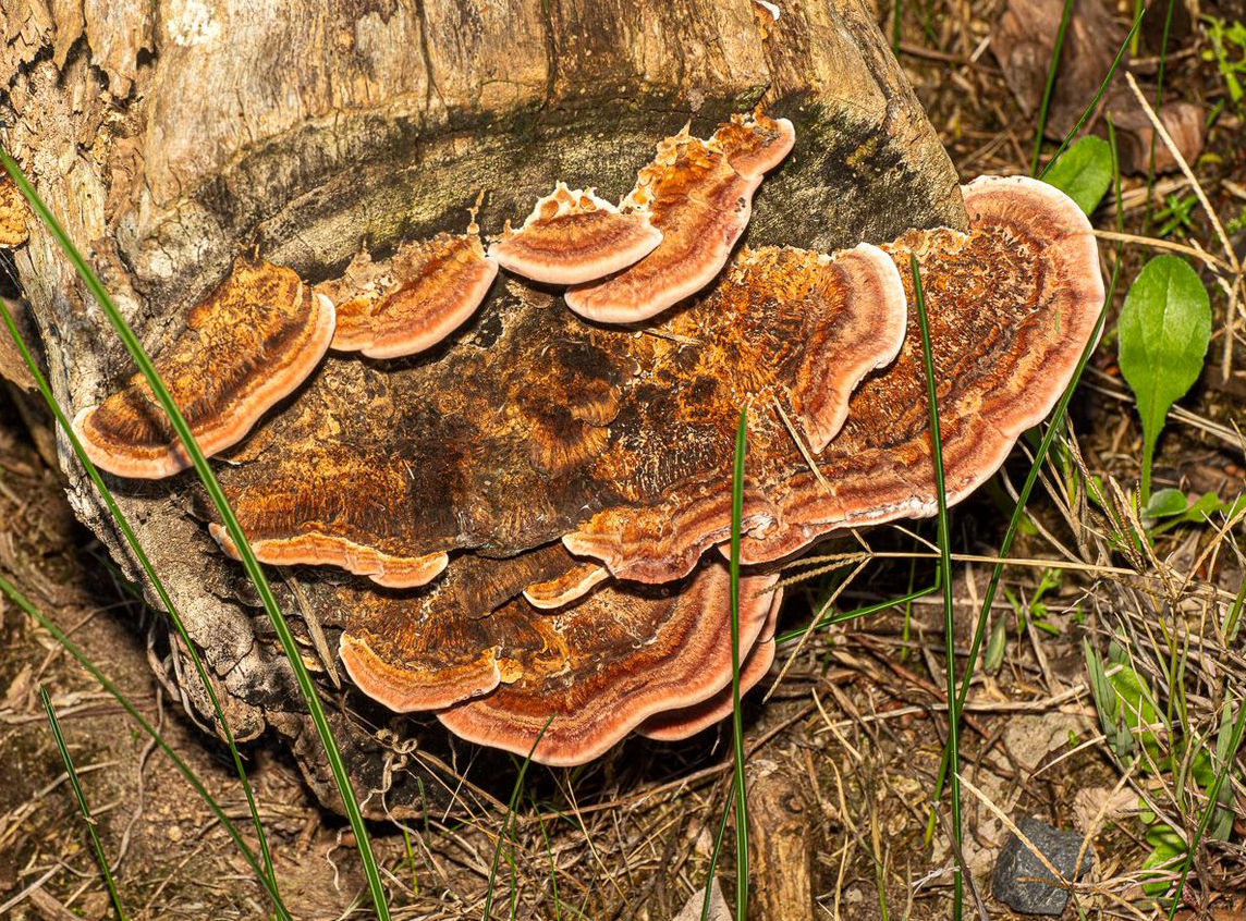
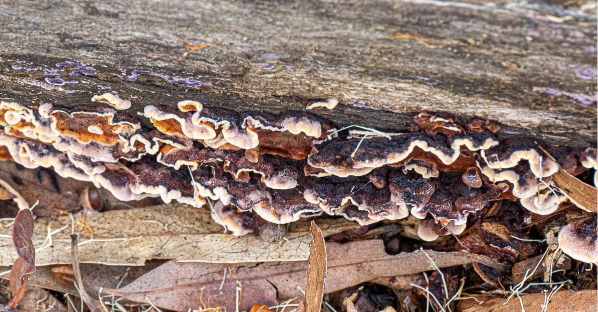
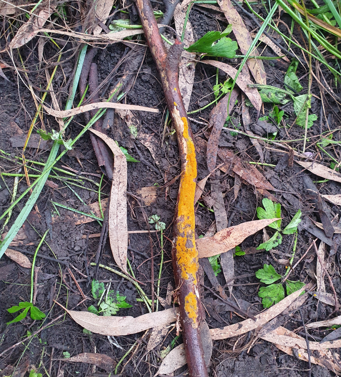
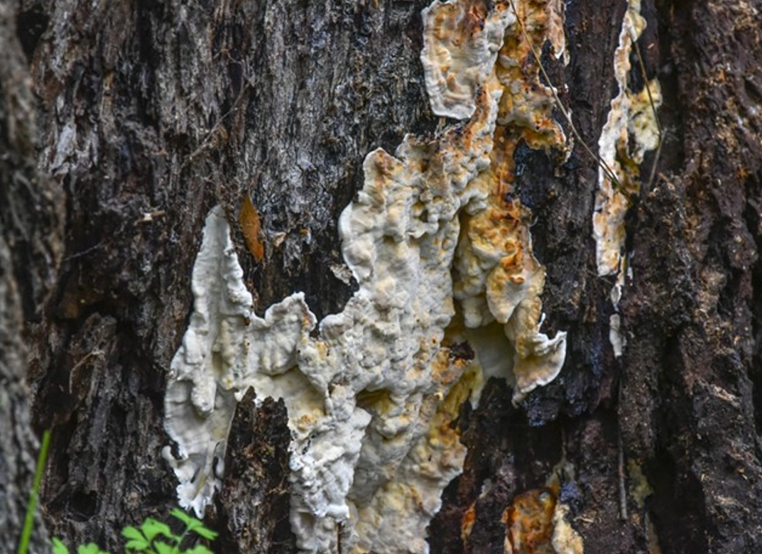
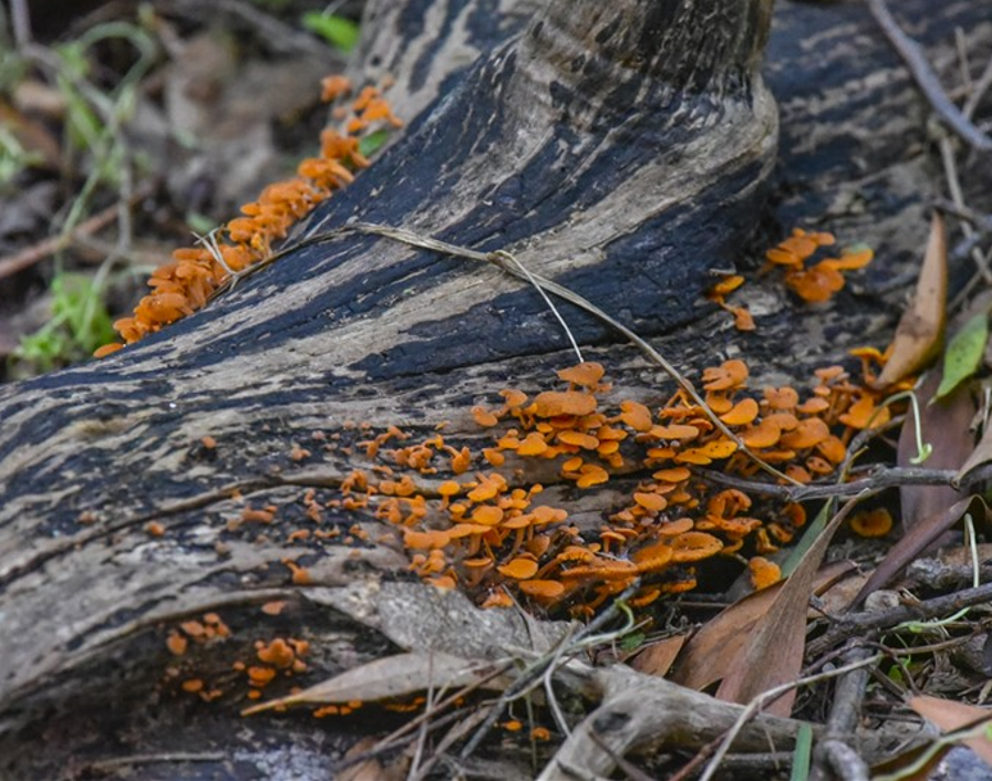
Unfortunately, the last fungus shown seems to be the highly invasive Orange Pore fungus or Orange Ping-Pong Bat (Favolaschia calocera). That fungus is believed to have originated in tropical Africa but has invaded many parts of the world including non-tropical Switzerland – not the first species to come out of Africa and dominate the globe! Council tells us that there’s not much we can do about it now that it is present (since the early 2020s). However, if you are visiting a sensitive area, please clean your boots carefully before going there. A solution of metho and water is usually used.
Needless to say, Friends should never consume fungi sourced from the park. Misidentification is very easily done – and can be lethal!
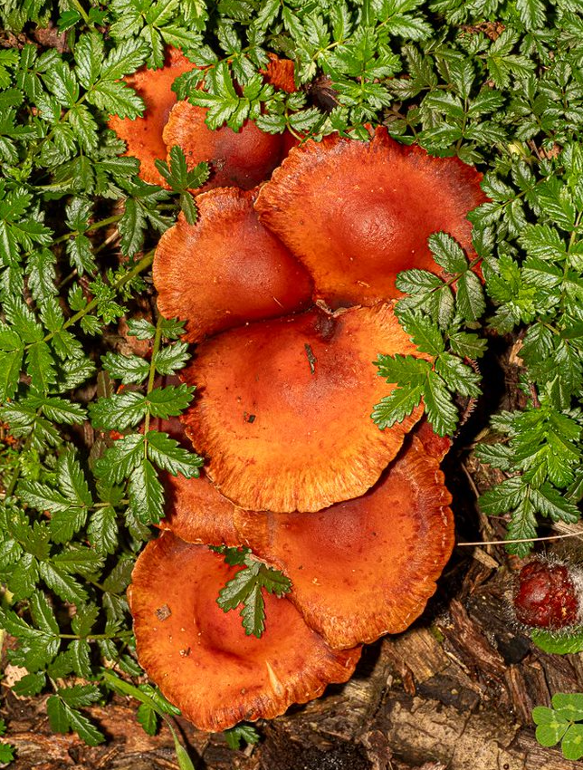
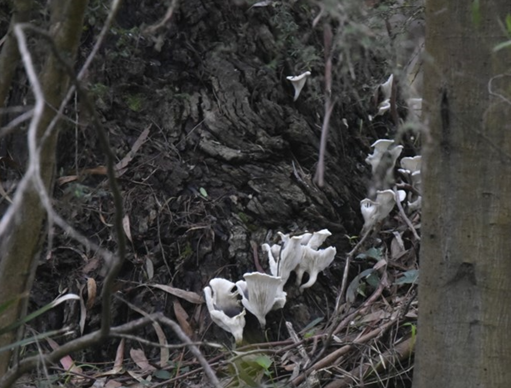
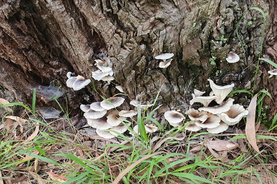
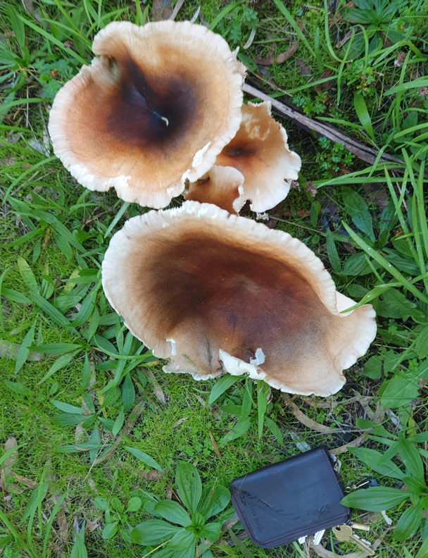
Ghosts Everywhere !
The Ghost Fungus seems to be having a particularly good year (that’s a keycase for scale in the last photo) :
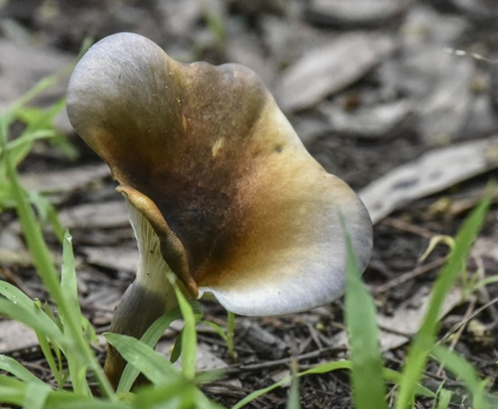
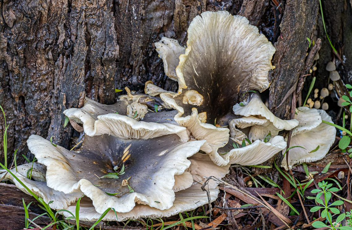
The Ghost Fungus (Omphalotus nidiformis) is probably Australia’s best known luminous fungus. As far as we know, no-one has tried to brave the mosquitoes and set up a tripod to take a time-lapse photo like Lisa did last year:
Their soft bioluminescence is due to a reaction between enzymes inside the fungus and oxygen (ie they don’t need to be exposed to sunlight during the day to absorb light to release at night).
Thursday Team Report
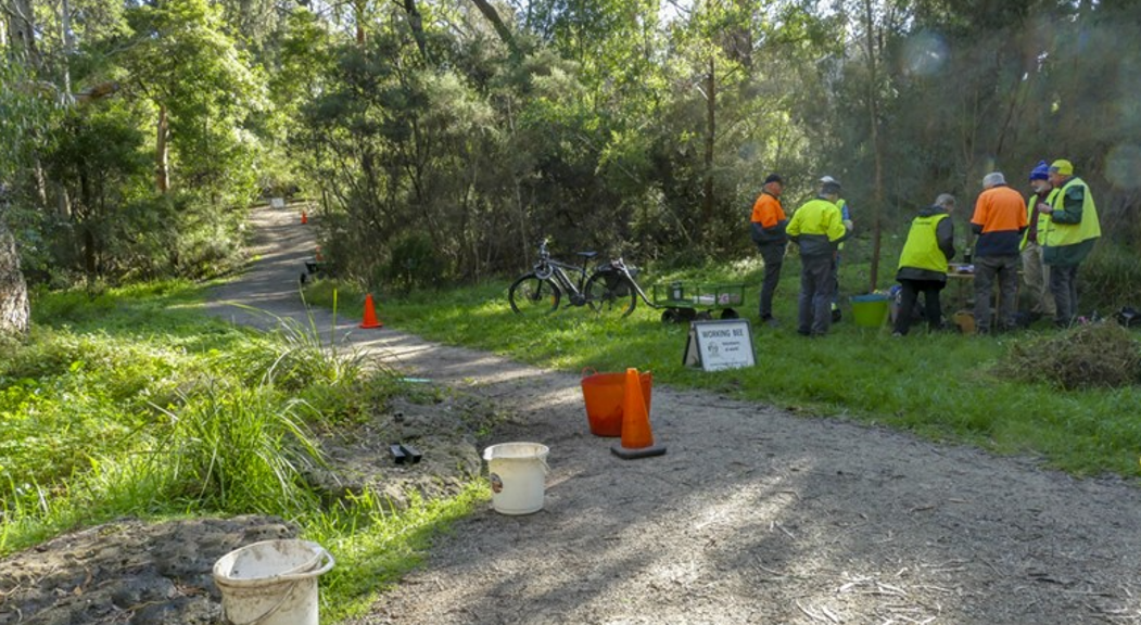
One of the (few) benefits of getting into May in the calendar is that our Thursday group can start in-fill planting (new plants in existing beds eg to replace something that has died). Our photo shows a rest break during our first planting session in Furness Park in its northeast corner.
Otherwise the group has been busy doing prep work for the 2nd June Community Working Bee (full report next month), also weeding the billabong area in Kalang Park and in beds in the vicinity of the Scout Hall in Blacks Walk.
Council Works
Zebra Crossing at Main Street Bridge
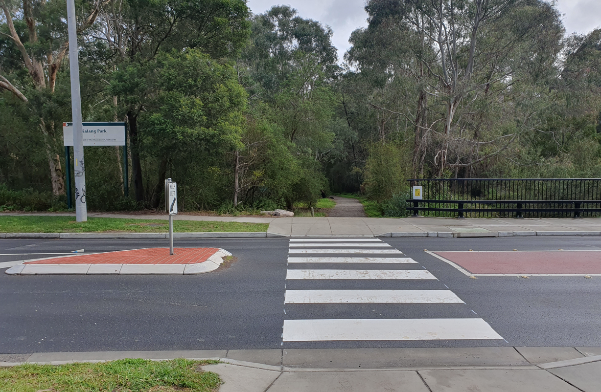
Somewhat out of the blue, Council contractors commenced installation of a zebra crossing at Main Street on 31/5 – connecting Kalang and Furness Parks on the south side of the creek. We believe the crossing will significantly improve the safety of park users crossing busy Main Street.
We were informed more than two years ago that Council would evaluate the traffic calming etc impact of the two flat-top speed humps installed with the bridge replacement – to determine whether a zebra crossing was actually needed. It seems the answer was “yes”!
Help with tools and equipment
We recently received the first instalment of help from Council in the way of tools, supplies and a first-aid kit. We are grateful for that assistance and are expecting further items (eg Volunteer fluoro safety vests) to complete the order.
Sustainability Event
Readers may be interested in a forthcoming event being run by Whitehorse City Council’s Sustainable Living 2024 program:
Legendary YouTuber and author of The Backyard Adventurer, Beau Miles brings his oddball style to Whitehorse as part of our Backyard Eco-adventure Expo. His stories and our local enviro groups will inspire you to think and act differently in your own backyard.
When: Sunday 23 June, 1:15pm for a 1:30pm start to 4pm
Where: The Round, 379-399 Whitehorse Road, Nunawading
Cost: Free. Bookings essential **This is our biggest event of the year, so we hope you can attend.
Our group was not invited to participate – apparently we are not known as a “local enviro group” within Whitehorse. I guess that’s because we’ve only been around 40 years fighting and working for our local environment! Thankfully, the KooyongKoot Alliance will be there and will represent us as one of its member groups.
Volunteer Training

To celebrate Volunteer Week (ending on 23/5), Council organised a Sunday morning/early afternoon training session with the amazing George Paras.
George gave practical and entertaining advice on “Tackling Weeds in Whitehorse” based on a walkthrough circuit from the Bowls Club car park to Blacks Walk hill and around – reaching a little further east than the Laurel Grove bridge before running out of time.
Three of our Thursday team attended along with several folks from other parks and the indigenous plant nurseries. Unfortunately, the date clashed with our 40th birthday celebration later in the afternoon which precluded several of our people from coming due to commitments to preparing for our event. Council has promised another session later in the year to make sure we all don’t miss out.
Child Safety Training
Naturally, children and young people are very welcome at our events – but do need to be supervised by a parent or guardian. In line with current policy, all our Committee members hold Working With Children Check cards – even though we generally do not have very much contact with children.
Children and young people (aged 17 and under) are protected by significant, fairly recent changes to relevant laws which provide strong child safety standards. Penalties apply for failure to protect a child or failure to report abuse – where there is reasonable belief that abuse is occurring. This applies to all staff and volunteers – and everyone else for that matter.
At Council’s invitation, we had a couple of reps present at a recent training session at Yarran Dheran to learn and understand the changes and impact on policies and procedures.
The 40th Birthday Quiz Answers

For those who were unable to come to the celebration, here are the answers to the quiz…
Firstly the map for your reference:
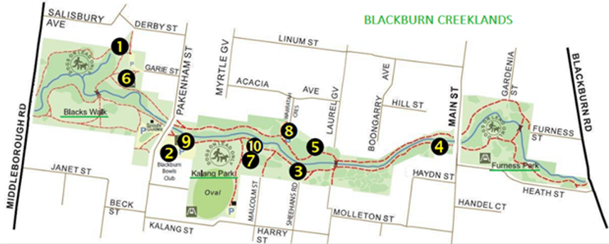
Photo A
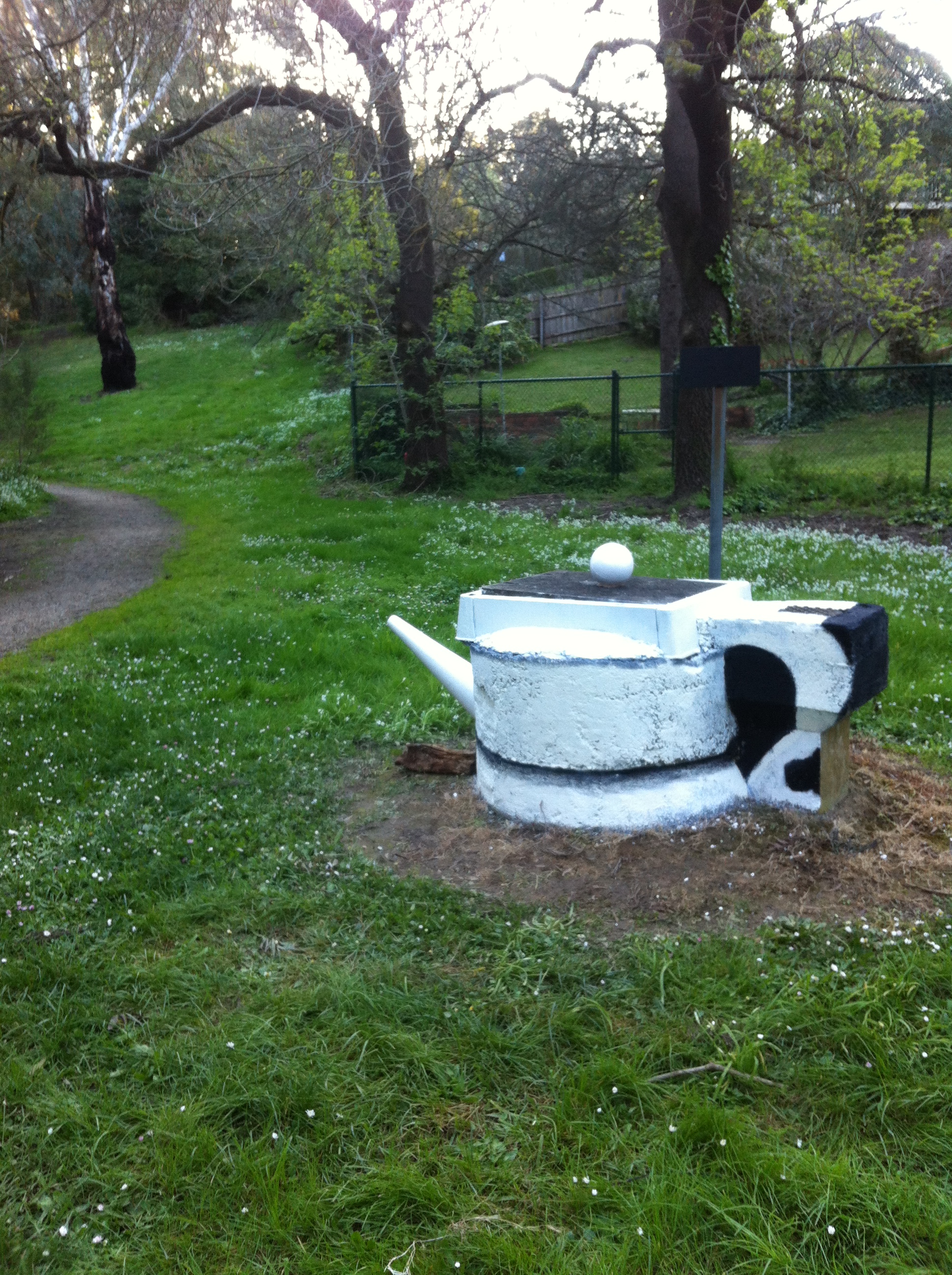
Photo A is at location 1 on the map. The teapot “art installation” mysteriously appeared in September, 2014 as a repurposing of an unusually elevated access cover to underground pipes (Blackburn Creek flows below).
Although not everyone’s cup of tea (groan!), the teapot struck a chord with several Friends. It was not intended to be more than a transient feature with the crockery extensions being moulded polystyrene. Within a month, art volunteers assisted with running repairs to prop up the sagging spout with a stick and retrieve the teapot lid’s polystyrene ball handle when it blew away in strong winds.
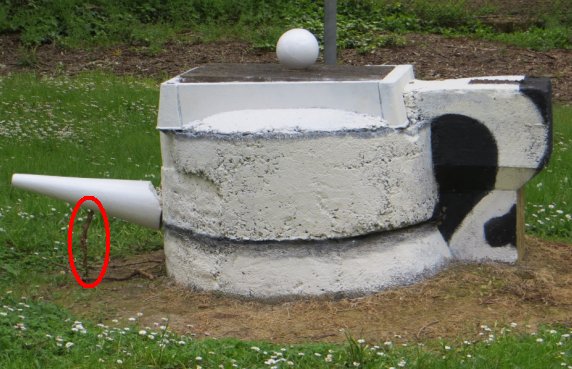
Alas, the repairs were only temporary – the teapot looks more like a sad, squat tankard now – sans spout and lid handle… but still attracts, perhaps less imaginative, “artists”.
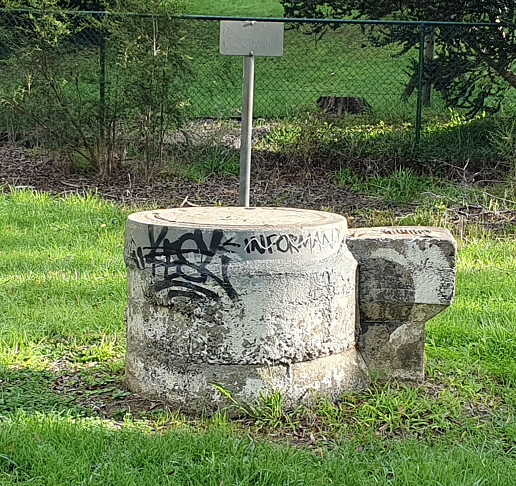
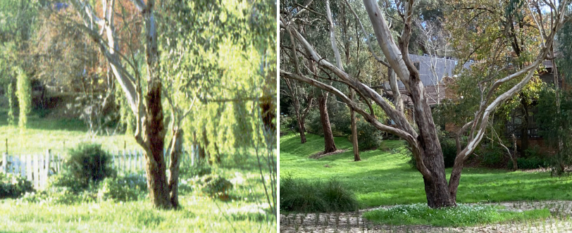
Photo B
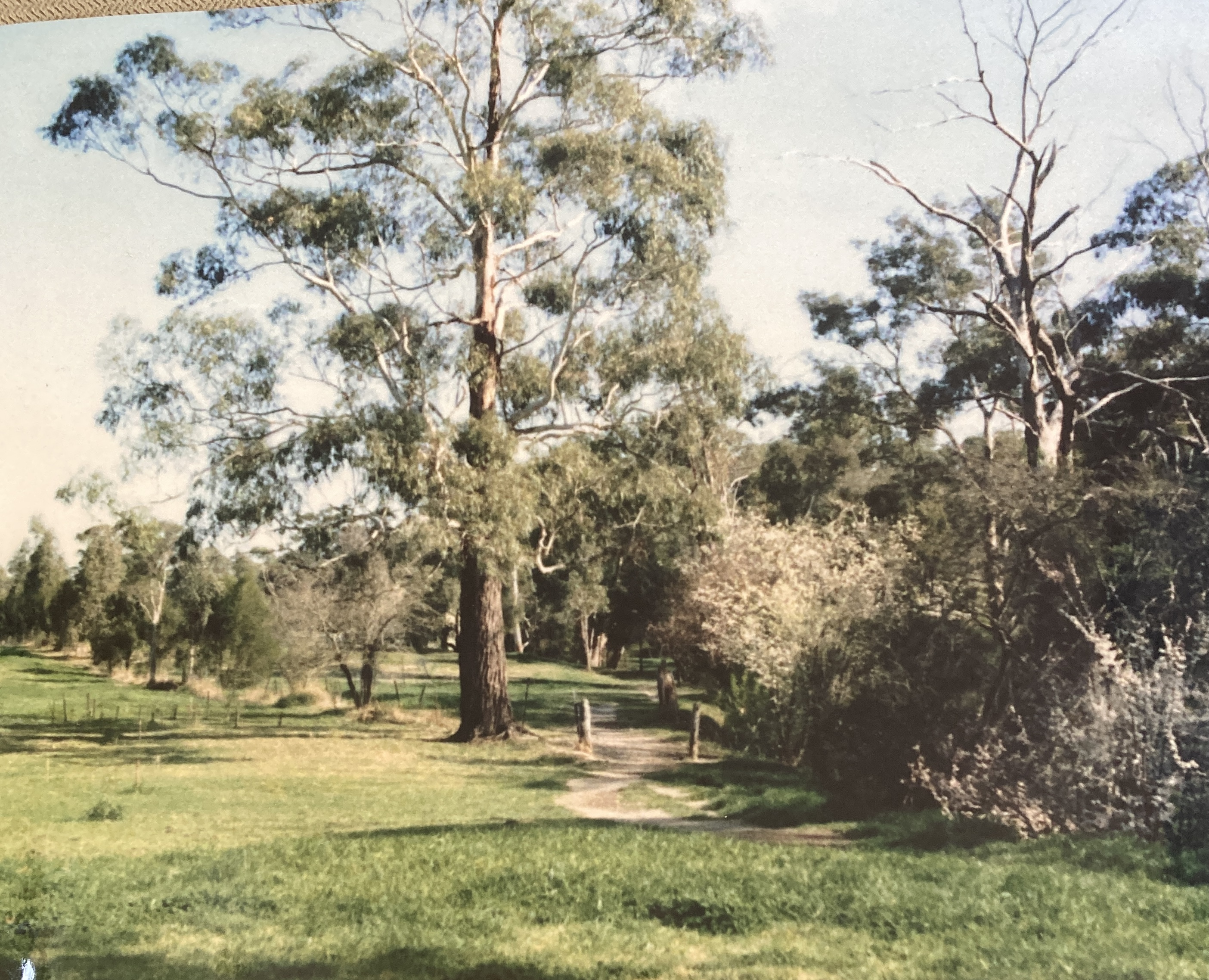
Photo B is at location 3 on the map. We are looking west roughly intersecting with the Sheehans Road entrance to the park on the south side of the creek. Nowadays, the track is further back from the creekbank and goes past the tree to its left.
Notice the post and wire paddock fences. Right up to the early 1980s, horses were agisted on the MMBW land that was added to the park. Removal of the fencing started around 1981 – firstly on the south side of the creek as leases were relinquished.
Looks like there were serious erosion problems then too!
Photo C
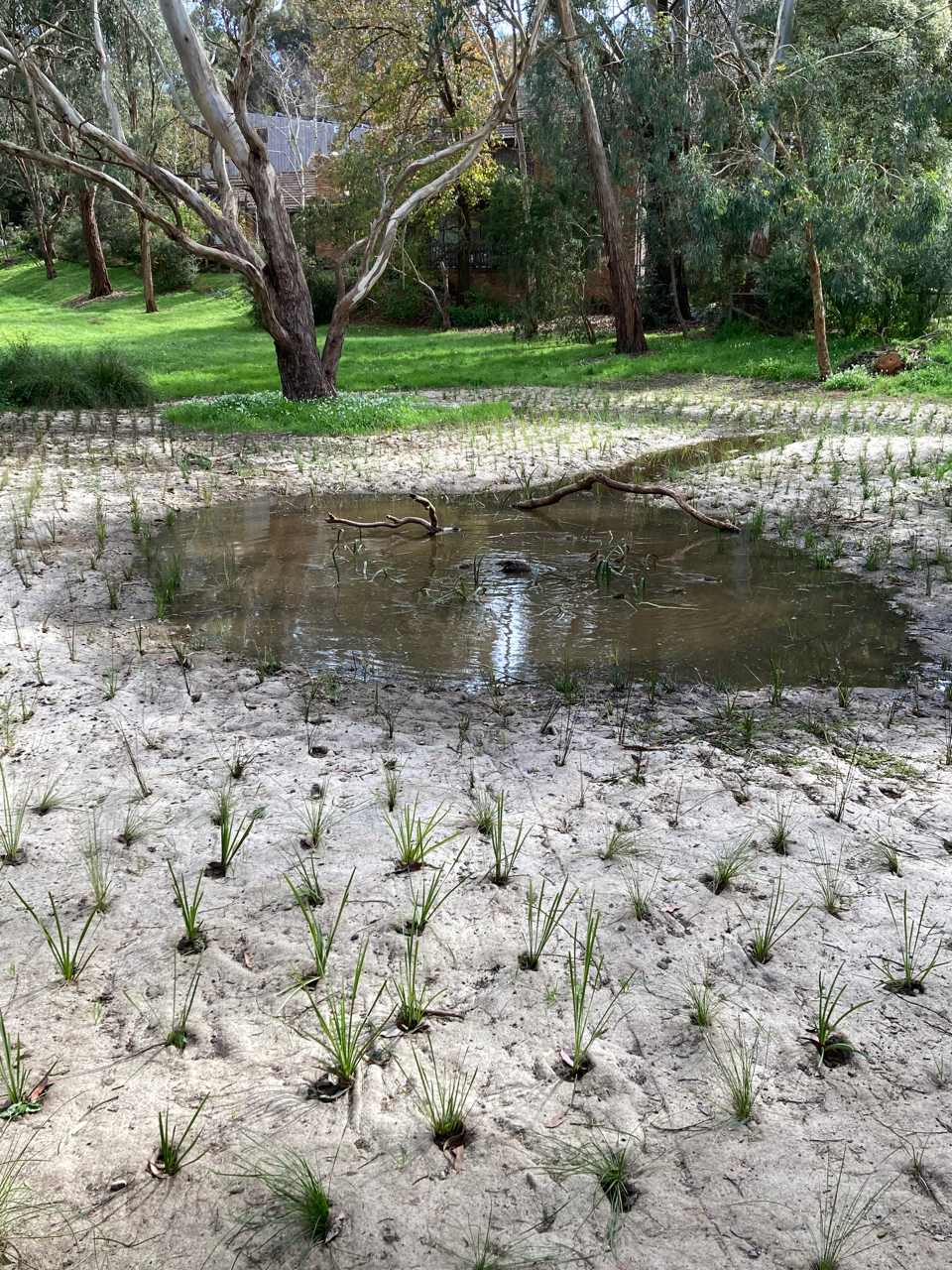
Photo C is at location 5 on the map. We are looking towards houses on the east side of Waratah Cres from the track on the northern side of the creek. This is the “new” wetland constructed in 2020 to take storm-water from Laurel Grove North and beyond. Storm-water is “cleaned” by the plants and wetland system before it enters the creek, the Yarra River, Port Phillip Bay, Bass Strait and the ocean in due course.
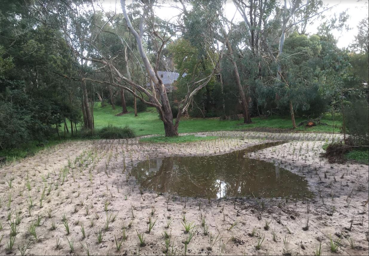
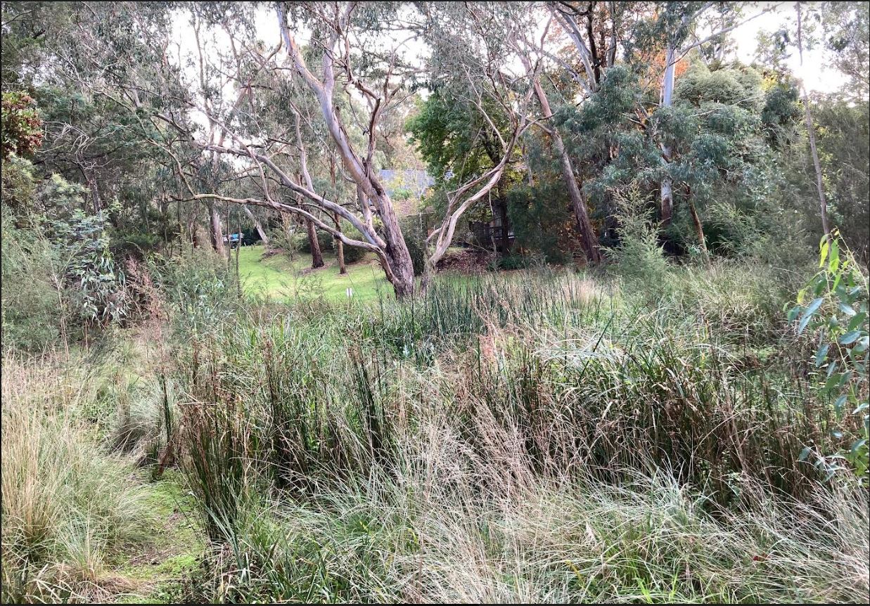
Slotted jute matting was laid on the ground after initial preparations with plants then planted through each slot. The jute matting suppresses weeds while the new plants get going and eventually breaks down. The slider below tells the story – in two years (2020 to 2022), the wetland had progressed from what looked like a dodgy hair transplant to a thriving and quite natural-looking environment (our thanks to Geoffrey for the before/after shots).
Photo D
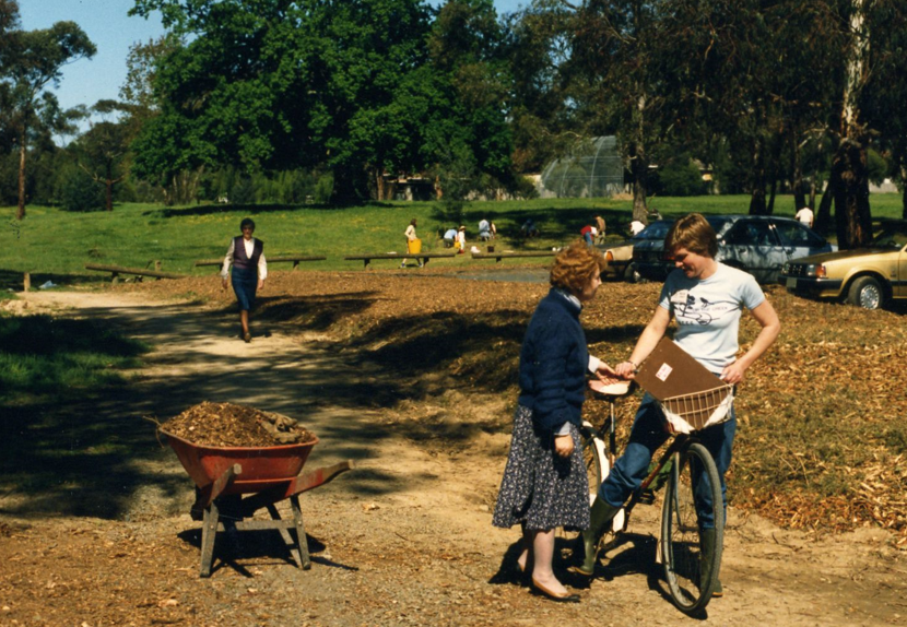
Photo D is at location 9 on the map. We are looking towards the old oak tree on the rise, Kalang Oval beyond including a curved structure known affectionately then as “The Igloo” to provide some protection from errant baseballs. The cars are parked at the far end of the Bowls Club carpark.
The photo was taken on the huge Project Regeneration day. We had twenty+ planting sites each with supervisors, throughout the length of the park and Megan was the go-between / bush telegraph -checking if anyone needed more plants, tools, volunteer person-power etc. Megan points out there were no mobile phones in those days! Clipboards were not on laptops either – they were some sort of baroque wooden structure apparently.
A series of baseball clubs played there beginning with the Blackburn Baseball Club in 1971. Alas, too many baseballs went over nearby fences – a campaign by Kalang Oval neighbours to Council eventually resulted in the baseball being relocated elsewhere around 1988. You can learn more about the history of baseball in our park here.
Photo E
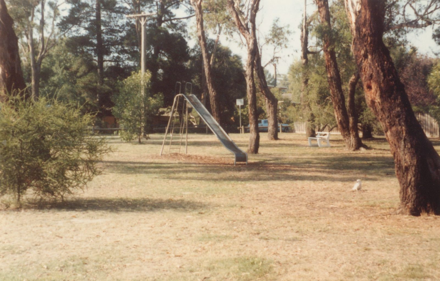
Photo E is at location 6 on the map. We are looking towards the last house on the north side of Garie Street from the park through the playground area. In those simpler times, a slide, a seat and a corella to look at comprised the playground equipment.
A little different from today’s version:
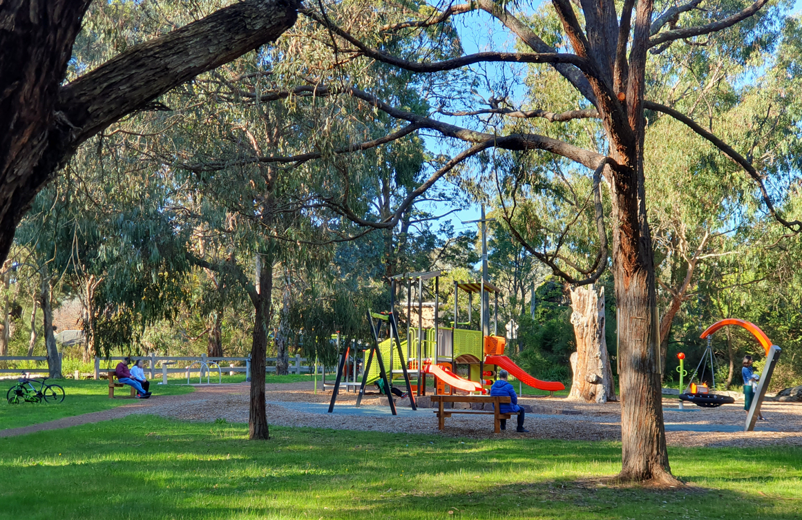
Photo F
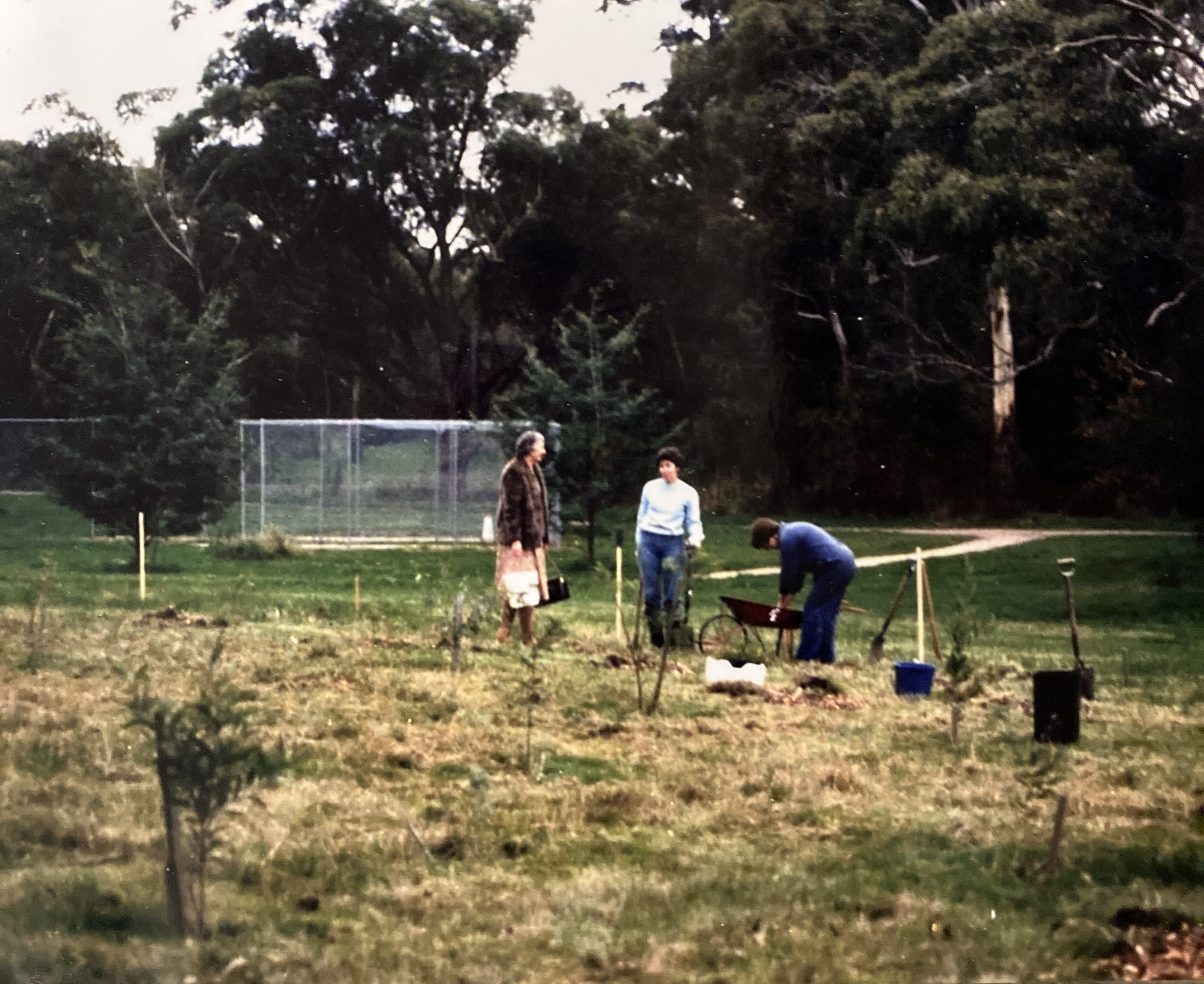
Photo F is at location 7 on the map. This photo is likely to have been taken on the 4th April,1982 to celebrate the BCCG’s first birthday – 140 plants having been donated by the Blackburn and District Tree Preservation Society.
We are looking towards cricket nets which were located much closer to the main track then. That’s the main track going from left to right in the middle distance with the track towards the Kalang Oval pavilion leading up the slope behind the working bee team.
Photo G
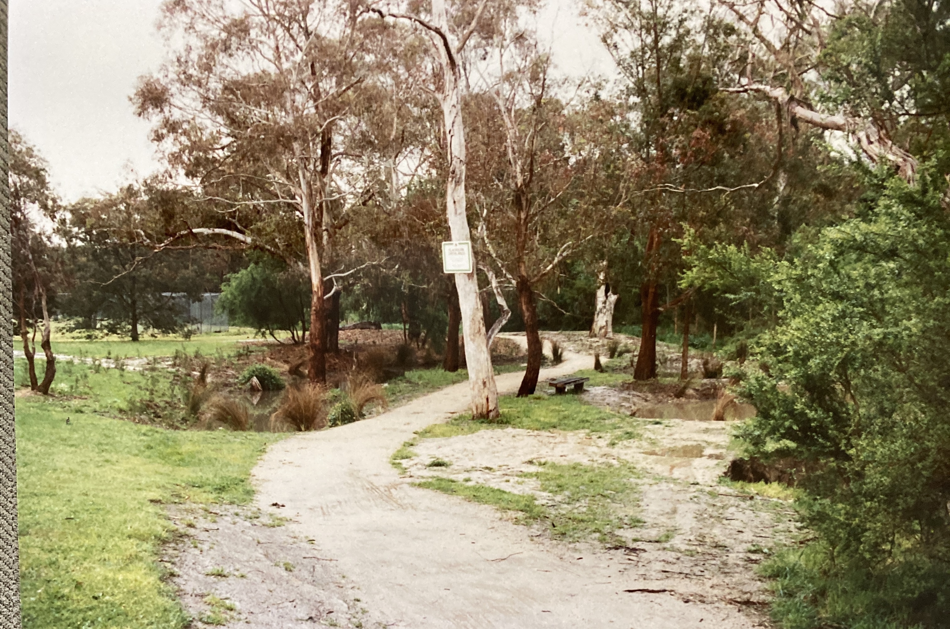
Photo G shows “The Billabong” at a rather early stage viewed from the eastern side. Both the main pond and the smaller pond on this side have water in them. That’s very unusual – it has only filled in more recent times on rare occasions when the creek has flooded over its banks nearby.
The tree at front, with the sign on it, died and was removed long ago. In 2015, a stormwater feed from Malcolm Street and the Kalang Oval Pavilion was completed to improve the water supply to the Billabong.
Photo H
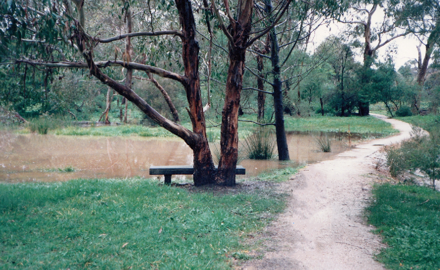
Photo H is at location 8 on the map. This is an early photo of the Waratah Wetlands where one could sit on the sleeper bench seat (only recently removed*) and view ducks on open water. That’s before the Bulrush and Phragmites wetland plants began to thrive doing their job of removing excess nutrients from the storm-water before it enters the creek.
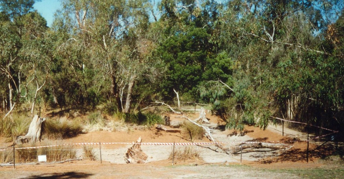
The Waratah Wetlands was a Bicentennial Project (1988) and is now a great spot for frogs. It is filled by water not only from the hillside and Waratah Crescent drains – but also via a swale that runs from Laurel Grove (North). Prior to excavation in 1988, it was a shallow soak infested with Blackberries and other weeds. Here’s how it looked before being filled with water, after more restoration work in the 1990s:
*Council has promised to install a new seat at the same location.
Photo I
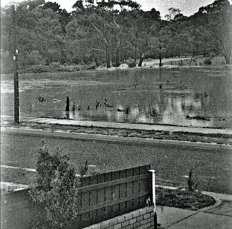
Photo I is at location 2 on the map. We are looking from the porch of the second house in Pakenham Street towards Canterbury Road from where Laburnum Primary School stands today. The creek, which is in flood and has gone over its banks, is in the upper portion of the photo. Locals called the area “The Swamp” at the time – it is now the location of the Blackburn Bowls Club. Our thanks to Frances who provided a copy of Mary’s, the then resident’s, photo.
The flood occurred on Australia Day, 1963 after 5 inches (about 125 mm) of rain was recorded. The Bowls Club was not built until 1967.
Mike’s photo shows another view of the event – Mary’s house has the white front fence and dark side fence in the photo.
Photo J
Photo J is at location 4 on the map. This photo was taken in the early 1990s. We are looking towards Furness Park over Main Street (partly visible as a sloping line going downhill on the centre left of the photo – but you can see the power-lines between the light green patches of tree canopy) from the main track south of the creek.
There was a MMBW house on the block at 62 Main Street (on the right hand side of the photo). The latter was demolished in 1984 to improve park accessibility and the land was incorporated into the park. The pine bollards were put in a couple of years later through many parts of the park to delineate the edge of the land still officially owned by MMBW as part of the creek edges. In more recent times, Council has found it simpler to take on management of all but the inside of the creek banks.
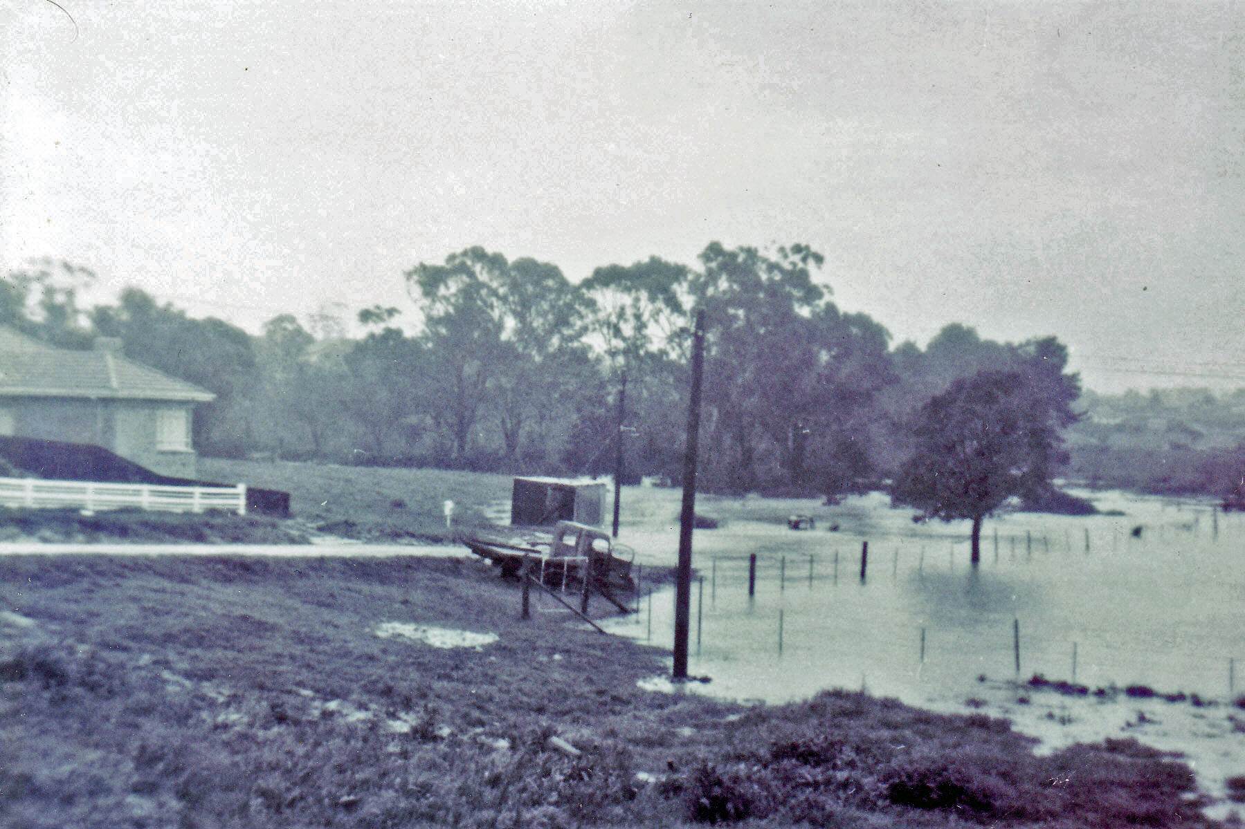
Photo K
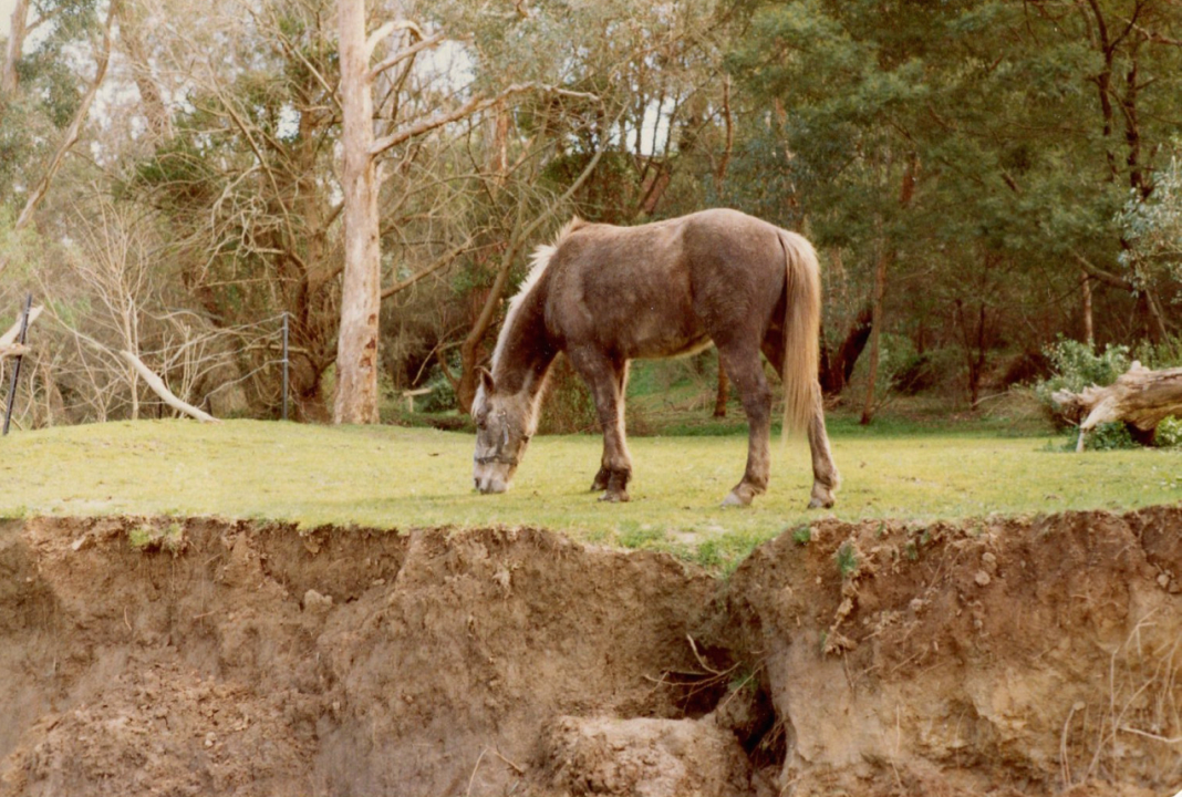
Photo K, which was available only in the on-line version of the quiz, was taken from a similar spot to location 5 on the map. It shows an interesting view of the Blackburn Creeklands most likely taken in 1982 or early 1983 – in the very early days of our park. We are looking across horse paddocks to the end of Waratah Crescent roughly from the direction of the Laurel Grove bridge.
Nowadays the “new” wetland (Photo C) and Waratah Wetland (Photo H) would fill the lower right and middle distance left of the photo respectively. The weedy Willows are long gone – but could that be the same Manna Gum in the mid-ground in both photos? Please allow for a different viewing angle, tree age and the weight of longer branches tending to spread the tree out.
As per the description of Photo B, the fencing was there to control horses – they did a great job of keeping the grasses neatly cropped! Mr Palmer, who lived nearby, had a leasehold of the area which he sublet to local families for horse grazing/agistment.
Analysis
Our IT department could not rest until they’d done a full analysis of the (anonymized) results from the on-line responses to the quiz – samples are shown below:
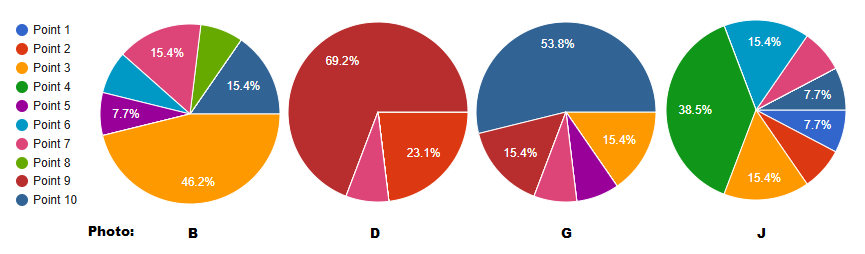
Several questions were “easy” (Photos A, C, D, E, F and H) with about two thirds or better of responses correct. Less than half got Photo B right – but still a clear majority. Perhaps surprisingly, only a little over half got the Billabong right (Photo G). Photo J evinced the largest number of incorrect guesses. Understandably, it, and our oldest photo (I), gave people the most trouble with less than 40% of people getting them right.
The most common answer to the bonus question was “No idea!“…
We hope you enjoyed the quiz and had as much fun as we did assembling it! We are very fortunate that Megan had so many old photos in her archive to puzzle us with! Special thanks also go to Ruby who developed the concept and the core technology to be able to run the questions on-line.
