Events coming up:
- Blackburn Creeklands Working Bee: Sunday 7 July 09:00-12:00 – NAIDOC Week
- Launch of Blackburn Lake Regeneration Project: Sunday 21 July 09:00-12:00
- Blackburn Creeklands AGM: Tuesday 23 July 07:30 PM
- Blackburn Creeklands Working Bee: Sunday 28 July 09:00-12:00 – National Tree Day
What Wildflowers ???!!!
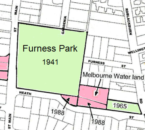
At last month’s 40th Birthday Party, it was stated that Council acquired the main block of Furness Park (adjacent Main Street) in 1941 – primarily to conserve wildflowers.
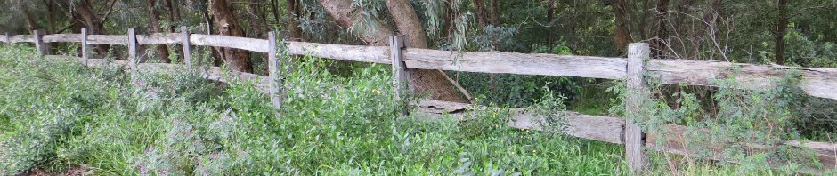
With all due respect to Furness Park, the notion of it being resplendent with wildflowers may not be the first thing you think of! These days, the area is probably better known for its canopy of mature eucalypts and an under-story of indigenous shrubs. It is also home to a variety of bird species, a children’s playground, creek views and walking tracks.
So – what were the wildflowers being conserved ?
One clue is that Heath Street forms the southern boundary of the park.
Another clue is that the original name of Furness Street was Orchid Street – before being renamed after Mr Albert George Furness who was a local businessman, President of the Blackburn Progress Association pre WWII and resident of Laurel Grove (north). Nowadays, orchids are poorly represented in the Creeklands. Nevertheless, Nodding Greenhoods remain very impressive at Blackburn Lake Sanctuary in season.
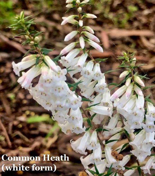
Fortunately for our research, the late Mrs Hilda Zappe (who was a founding member of the Creeklands Advisory Committee), compiled a list around 1990 of plants present in the 1940s – sourced from an early resident – Mrs Lettie Dickson. Sure enough, the Heath and orchids are listed – along with several other wildflowers.
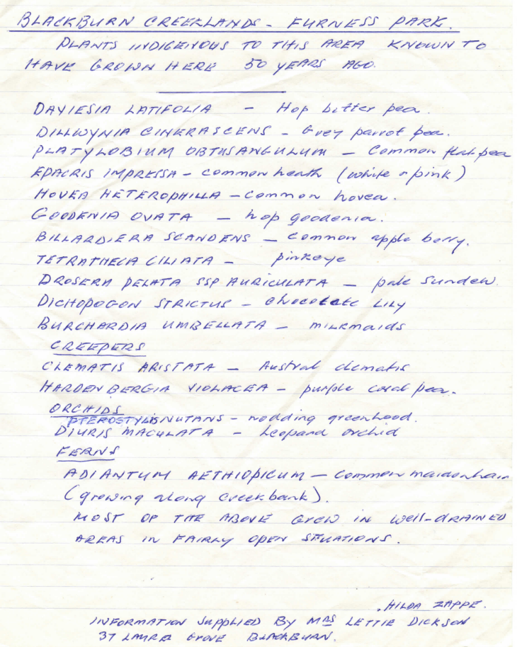
Interestingly, several of the above species do not appear in the Flora of Melbourne for our park. Parts of Furness Park were opened up for grassed areas (Kikuyu – green in Summer without watering!) and the playground. One suspects that repeated mowing before flowering would likely have wiped many of the species out. However, after your Committee arranged with Council to stop mowing in the current “no mow” area near to the playground, Chocolate Lilies (now named Arthropodium strictum) reappeared in surprising numbers. This plant has long grass-like leaves with a single violet (rarely white) flower on stalks. They have a chocolatey scent which explains their common name.
Though a spectacular flower, they are sparse and not “in your face”. The same might be said of flowers like the Sundew. Perhaps less so of the Milkmaid and Pinkeye.
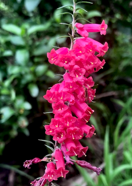
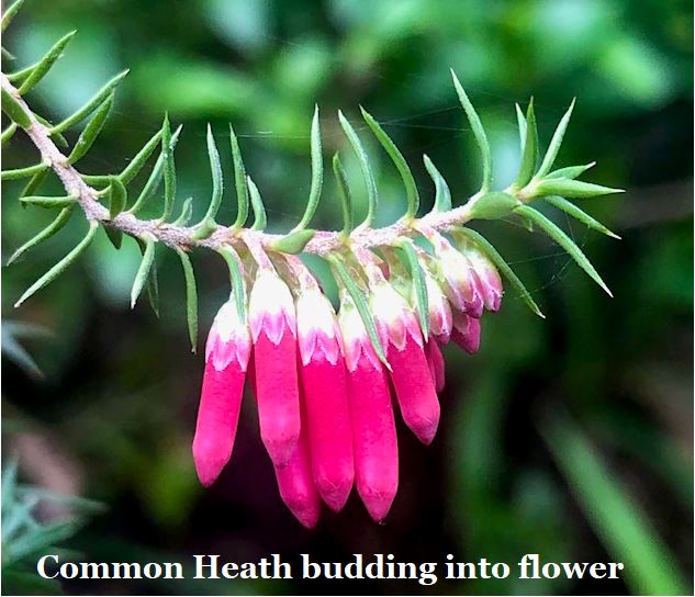
We conclude then that is most likely that an impressive display of Epacris impressa – which is Victoria’s floral emblem – would have justified both the name of Heath Street and the preservation of the species in a reserve – and expenditure on such project during wartime. The so-called “Common Heath” is not so common today – there is known to be a special symbiosis between a fungi/soil bugs and Epacris species which makes them hard to grow. Maybe, we should try again in Furness Park – assuming the fungus remains present ?
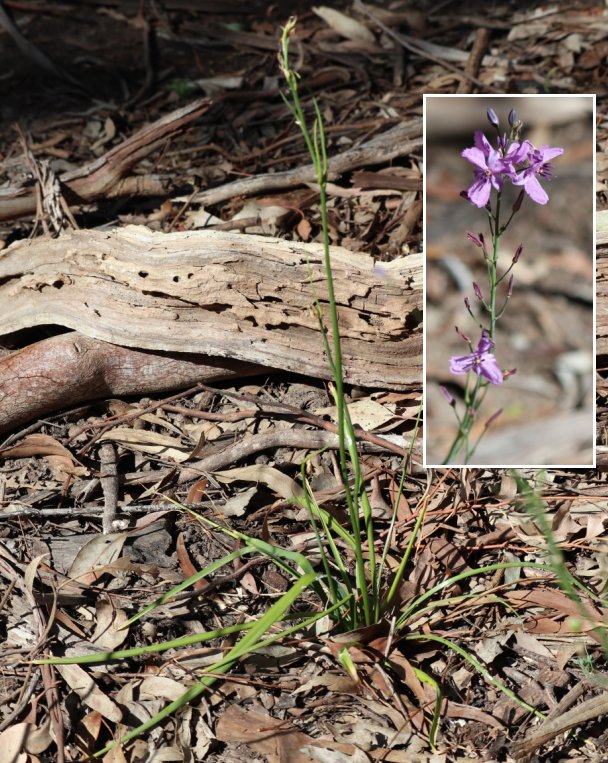
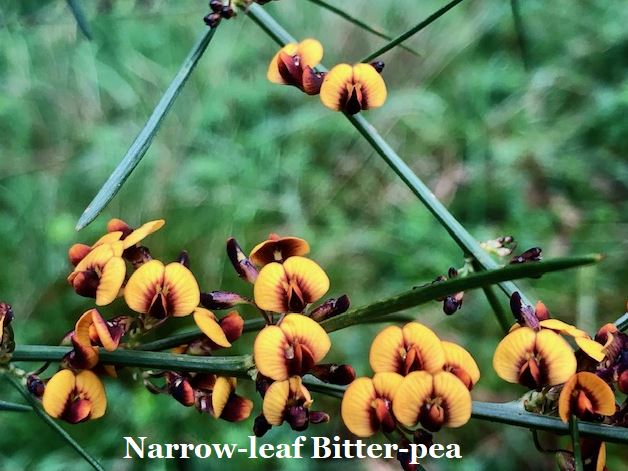
Here are some photos of plants in Hilda’s list taken by Lisa in August 2021 elsewhere in the Creeklands (Kalang Park) where there are a small number of examples:
Incidentally, Hilda also prepared another list in 1990 for the hill north of the creek in Kalang Park – plants present in the early 1950s before and after her home was built in Acacia Avenue in 1953.
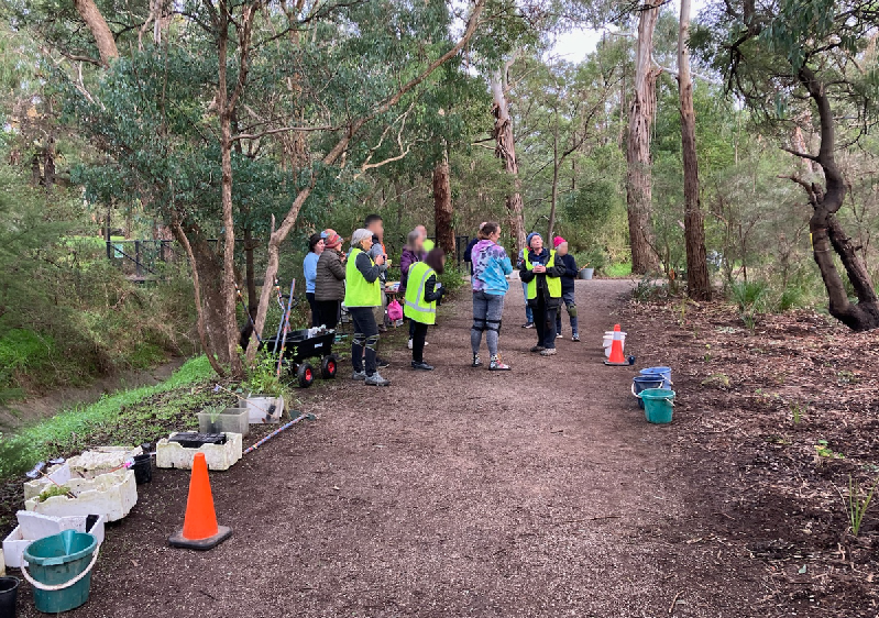
Sunday Community Working Bee report
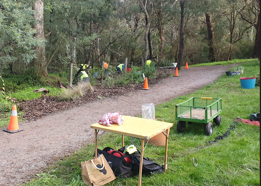
Our first Sunday community working bee for the season was successfully held on the 2nd June just north and east of the Laurel Grove bridge, extending last year’s plantings nearby.
It was great to welcome new participants and catch up with old friends. There was a cool start to the day but conditions were excellent for digging and planting.
NAIDOC Week 7-14th July
The poster below is the 2024 National NAIDOC Poster incorporating the Aboriginal Flag and the Torres Strait Islander Flag (licensed by the Torres Strait Island Council).

NAIDOC Week celebrations are held across Australia in the first week of July each year, to celebrate and recognise the history, culture and achievements of Aboriginal and Torres Strait Islander peoples. NAIDOC Week is an opportunity for all Australians to learn about First Nations cultures and histories – and participate in celebrations of the oldest, continuous living cultures on earth.
We are celebrating the week with our next Community Working Bee on Sunday, 7th July which includes planting in the park, weeding and a talk on traditional uses of our indigenous plants.
The location of the work-site is in Kalang Park – south of the creek between the Laurel Grove bridge and Main Street.
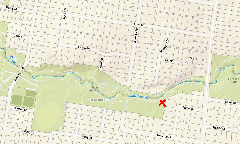
The event will run between 09:00-12:00 with morning tea and the talk at about 10:00. Our work will complement recent plantings in the vicinity by Council.
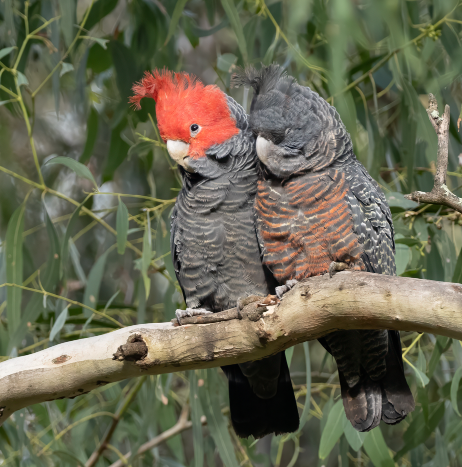
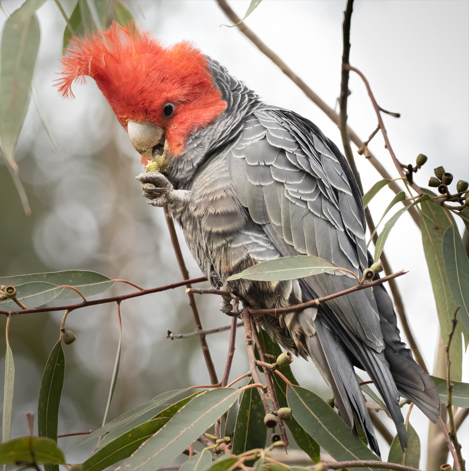
Gang-gang Cockatoos
We are very pleased that Gang-gang Cockatoos are still a common sight in the Creeklands. Many know that the species is now on the endangered list due to so much of their habitat being destroyed in the 2019-20 Black Summer bushfires. It is wonderful that our park is providing resources for a good feed to keep them going. Greg took some great photos of a pair early in the month:
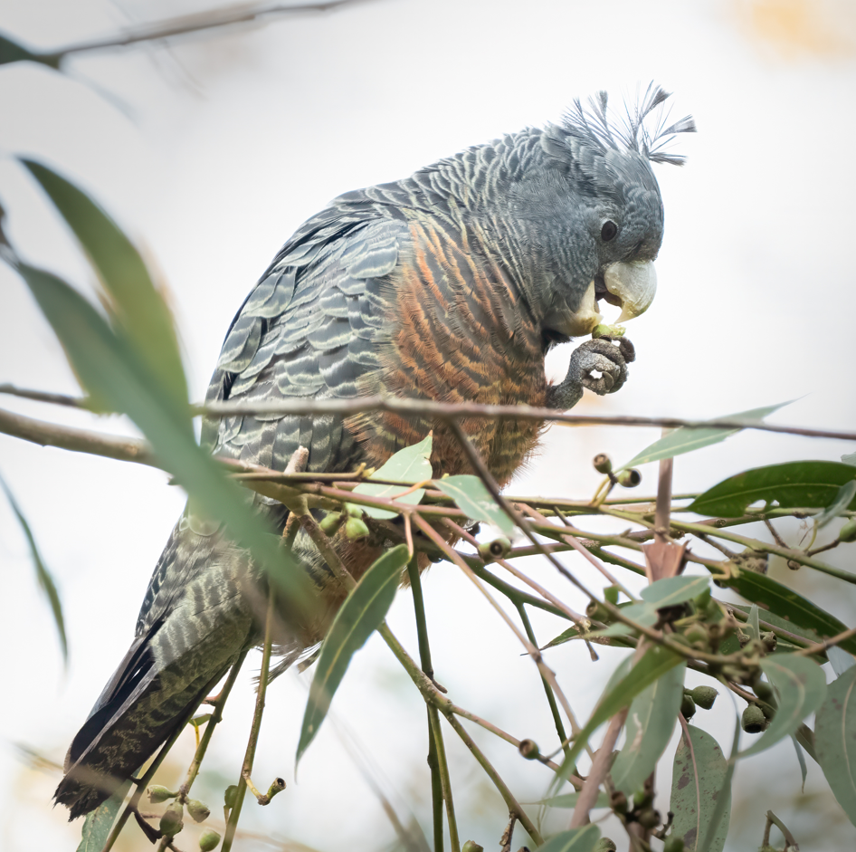
Please click on image to enlarge; click on the X to return
More Housing Density
In April this year, we reported that the Suburban Rail Loop Authority (SRLA) anticipates 40 storey buildings in the central Box Hill precinct with 15, 7, 6 and 4 storeys allowed away from the inner precinct. This followed news in February that the State Government announced its related (though far more generally applicable) “future homes” (aka apartments in three storey blocks), designed to densify Melbourne living and to increase the state’s housing stock by more than 2 million.
On Sunday 16th June, Premier Jacinta Allan and Planning Minister Sonya Kilkenny unveiled the draft targets for the number of dwellings for each council area in Victoria by 2051. These include significant new housing in the west and to the north of Melbourne as well as major densification in the municipalities comprised of middle suburbs such as Box Hill and Blackburn.
Whitehorse Council takes in Box Hill, Blackburn, Mitcham, Forest Hill and parts of Burwood, Nunawading, Mont Albert, Vermont and Surrey Hills. The state government proposes that Whitehorse Council accommodates 79,000 new dwellings, up from the 74,200 listed in the area in 2023.
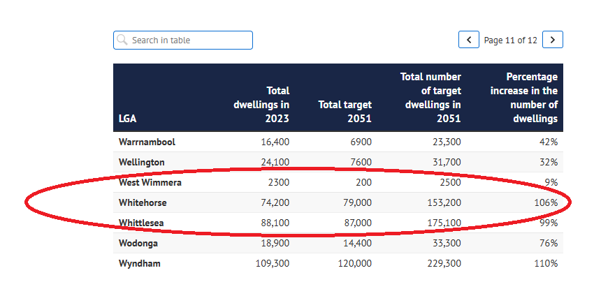
Is that significant ? It is more than the equivalent of putting another house or unit in place for every dwelling we have now! We are not alone though – neighbouring municipalities are also expected to jump 90+%. We can’t expect that Box Hill’s 40-50 storey flats are going to provide most of the additional dwellings – there will need to be substantial extra housing elsewhere in Whitehorse as well…
Obviously, population increases will put much pressure on open spaces like our park – not to mention infrastructure such as schools, hospitals and roads. There will also be major disruptions while these projects are built. We need green spaces for our physical and mental health. Box Hill residents will be particularly disadvantaged in future because there is very little green space there. Some locals have raised a petition that the SRLA acquire the old Federation Brickworks site as future open space to help address the problem. Otherwise, the new developments will not contribute much green space.
But wait – there’s more!
On 24th June, Planning Minister Kilkenny announced approval for the seven-tower Vicinity development in Box Hill.
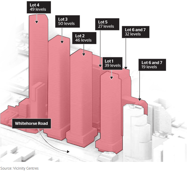
The smallest of the seven buildings will be 19 storeys, while the largest will rise 50 levels.
Box Hill’s current tallest building – the 36-storey Sky One apartment – will be dwarfed ! It is also the tallest building outside central Melbourne.
Thursday Team Report
The Thursday Team has been very busy in Kalang Park this month:
- Weeding preparations ahead of the 2nd June community working bee.
- Weeding the old project area on the southwest side of Laurel Grove bridge and a small bed further towards Main Street.
- Weeding the eastern end of the bed adjacent to the last community working bee site – of interest, Richard Welch MLC and one of his staff assisted our team.
- Weeding the patch along the track near the Waratah Crescent entrance and then further extending the bed by rolling the “Wandering Trad” back and mulching.
Council Works
Council has replaced the former sleeper seat on the edge of the Waratah Wetland.
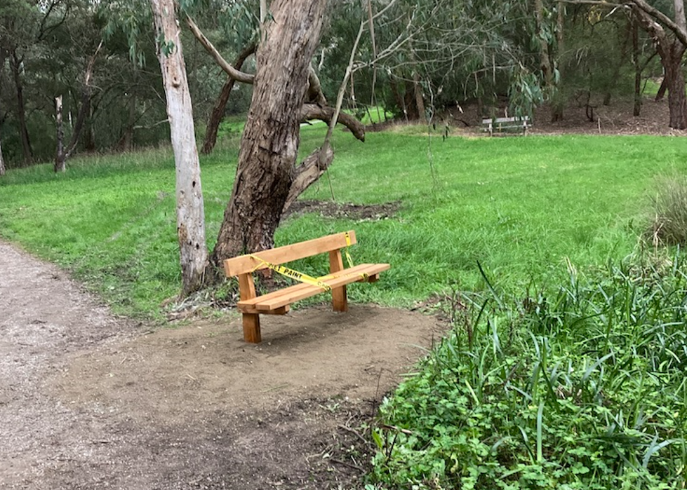
The location is very convenient for those on the walking track needing to take a breather.
Urban Forest “Dashboard”
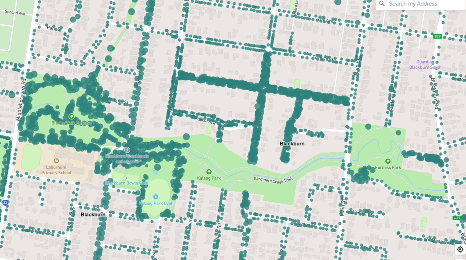
Council has recently launched a customer facing, interactive, Urban Forest Dashboard providing community access to information on its trees and related works from its tree management software – called Forestree. We had a couple of reps attending a session organised by the Combined Residents of Whitehorse (CROWAG) group with Council describing the new package and its application within our municipality.
Like a car’s dashboard shows key information such as speed, distance travelled and the amount of fuel in the tank, the idea is to show key data related to Council’s Urban Forest project. The “dashboard” is web-based and reports key measures and information related to internal KPIs (trees mapped, trees planted, species diversity, tree watering and tree works).
This snapshot from the package shows our park and its surrounding corridor. Clearly, data capture is incomplete and, to date, seems to have focussed on public safety – street trees, trees around kids’ playgrounds, along paths and the school boundary in Blacks Walk and western Kalang Park. Presumably, data collection in Furness Park and the eastern side of Kalang Park is still in the queue.
The Forestree software falls into the category of “asset management” software – but is particularly oriented to management of trees as living, growing “assets”. Council’s staff were clearly very enthusiastic about the benefits of the package (developed in South Australia). From what we learned, we can expect the management of trees in our public domain to be significantly improved.
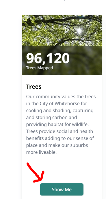
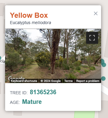
If you’d like to take a look at the street tree(s) outside your home, go to the dashboard and click the “Show Me” button on the Trees panel (see snapshot at left).
You can then zoom to your address or enter it via a search. Click on a particular tree to reveal its species and photograph. Beware, that the software relies on Google Street View imagery – which can be quite old…
What is the Urban Forest ?
All this begs the question, what is the Urban Forest ?
The ‘Urban Forest’ is comprised of the trees, shrubs and groundcovers, along with the soil and water they depend on, within the municipality (ie on both public and private land). It provides many benefits including:
- shade and cooling during hot weather.
- maintaining neighbourhood character,
- providing visual amenity,
- reducing the urban heat island effect in more urbanised areas,
- improving air quality, air/dust filtering and energy efficiency,
- providing habitat for fauna and supporting diversity generally,
- increasing the wellbeing of people and liveability of neighbourhoods,
- improving human physical and mental health including from social and natural “connectedness”,
- water retention reducing the risk of flooding – increasingly important as our climate changes.
One measure of the Urban Forest is the percentage of canopy cover – which is the percentage of tree foliage covering the surface below when viewed from above.
Several Councils adopted strategies for improved canopy cover from their respective Urban Forests in the early 2010s. Whitehorse was no exception and, in 2019, bravely adopted a target of Canopy Cover of at least 30% by 2030 under its Urban Forest Strategy when the then current estimate of tree cover was 22.9% across Whitehorse. This was extremely ambitious in the face of our housing trends towards “McMansions”, moonscaping development blocks and multi-unit subdivisions which all result in smaller garden areas and more limited opportunities for any vegetation, let alone canopy tree planting.
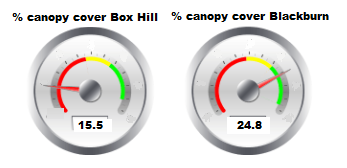
At the time DELWP (now DEECA) provided councils with LIDAR based data which showed alarming decreases from 2014 to 2018 as follows:
| Year | Box Hill | Blackburn | Source |
| 2014 | 18.5 | 28.5 | DELWP |
| 2018 | 15.5 | 24.8 | DELWP |
There was a reset in 2021 when Council set itself the still very challenging targets for the level of future canopy cover within the entire municipality of: 27% by 2031 and 30% by 2050 – which are still current.
Council reps tell us that there have been no further updates since 2018 (despite the alarming negative changes) – even though they were promised by DELWP (now DEECA). Council initiated its own study recently (which has not been released either – still undergoing data quality checks).
So, where is % Tree Canopy in the Urban Forest Dashboard ?
Clearly, % Tree Canopy is the critical measure to monitor as it measures performance to the key target.
However, the current dashboard measures only reflect the KPIs Council has for its operations in the Council public domain. Clearly, street trees and parks such as ours will play a significant role – but there is not enough public land to reach those ambitious targets for canopy cover – private property, including new developments, will have to help!
The developing sad story of SLO9
Council has no direct control over the private domain except that it can propose, implement and enforce related planning policies, controls and objectives with the approval of the State Government. While Council’s performance on tree protection has been patchy, one good example is Council’s Significant Landscape Overlay 9 (SLO9) planning control.
Whitehorse’s current SLO9 ensures the entire municipality has tree protections. SLO9 has been granted temporary extension by the State Government for 12 months at a time – several times on a rolling basis since its introduction in 2020. However, the most recent extension has been limited to 6 months… We can only deduce that the State Government sees conflict between SLO9 and some other future control it is working on and/or initiatives such as its “Future Homes” proposal (favoured 3 storey blocks of flats within the General Residential Zone). The likely outcome seems to imply further decline in tree canopy and other vegetation in our residential areas because any statewide control is likely to be weaker – if not jettisoned altogether.
Apples and apples
There’s another problem … LIDAR is a remote sensing system that uses pulsed laser light from an aeroplane to measure distances to the earth below which can include the height of “plants”. The data has to be interpreted via parameters to recognise plants, to measure height (eg in the DELWP studies, any vegetation over three metres tall was declared to be “canopy”) and has to be processed to eliminate false data (eg in the recent Council data, roof skylights appeared to be “trees” due to some vagary of their reflections).
In other words, to compare apples with apples – the same parameters need to be used by Council and DELWP (and Council officers don’t know what they were precisely!). Presumably, there have been changes in technology in the mix as well. This implies the targets (27% by 2031 and 30% by 2050) are potentially uncertain as well as ambitious!
We trust that a reasonable facsimile of the DELWP approach can be replicated by Council and that we will have tolerably accurate data to test that the alarming fall in canopy cover between 2014 and 2018 has been has been arrested and corrected. We trust further that Council will publish the data on its dashboard ASAP.
State Planning Minister Kilkenny was recently quoted (The Age 24/6)
With Melbourne’s population set to be the size of London by 2050, we’re pulling every lever we can to ensure we can get thousands of new homes for Victorians off the ground faster – where they want to live
The Suburban Rail Loop could leave Box Hill with a “catastrophic” lack of parkland, according to the Whitehorse mayor (Denise Massoud – The Age 16/5). Not only is the consequent pressure on our park a major concern, it is certainly hard not to be pessimistic about Whitehorse ever achieving its canopy goals in the face of these State Government decisions.
In the Corridor
Blackburn Lake wetlands regeneration project
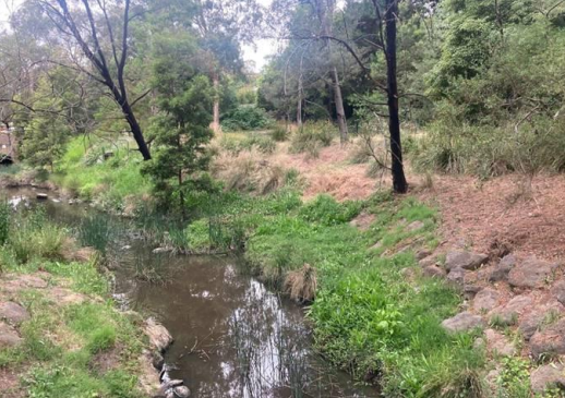
Our friends at Blackburn Lake have an exciting new project to regenerate wetlands on the inlet side of the lake. After removing weeds, they will plant 4,000 indigenous plants – upper storey, mid-storey and ground covers.
The first step is a Celebration & Information session for the community answering the questions:
- Why do the wetlands need to be regenerated?
- What will the project entail?
- What are the benefits?
- How can you get involved in this exciting project?
We are all invited to come along and find out more:
- All welcome!
- Sunday, 21st July at 2 pm – Blackburn Lake Sanctuary Visitor Centre
- Afternoon tea provided.
For more information on the project, you can also read their brochure here.
Ian Moodie Retires from Council
We were fortunate to be invited to farewell Whitehorse Council’s Ian Moodie at a function for volunteers at Blackburn Lake Sanctuary.
Several speakers spoke very warmly about Ian’s special contributions to the welfare of the environment in Whitehorse since his initial placement with Council as a student.
Here he is thanking everyone for their good wishes. Some of his amazing photography is displayed on the screen behind.
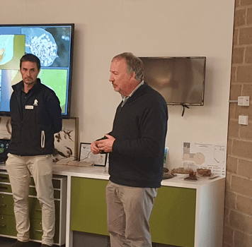
Ian has been a great friend of the Creeklands and Whitehorse’s bushland parks more generally over many, many years. For example, Ian acted as one of our bird walk leaders in every one of our twice yearly events ever since their inception in 2012. In fact, during the Covid restrictions, he organised a similar Council-run event in the Creeklands when we couldn’t as a volunteer group!
All is not lost! Ian’s special skills and expertise may still be available to us in volunteer and consultant capacities. We extend our gratitude and best wishes to him as he enters the next chapter of his life.
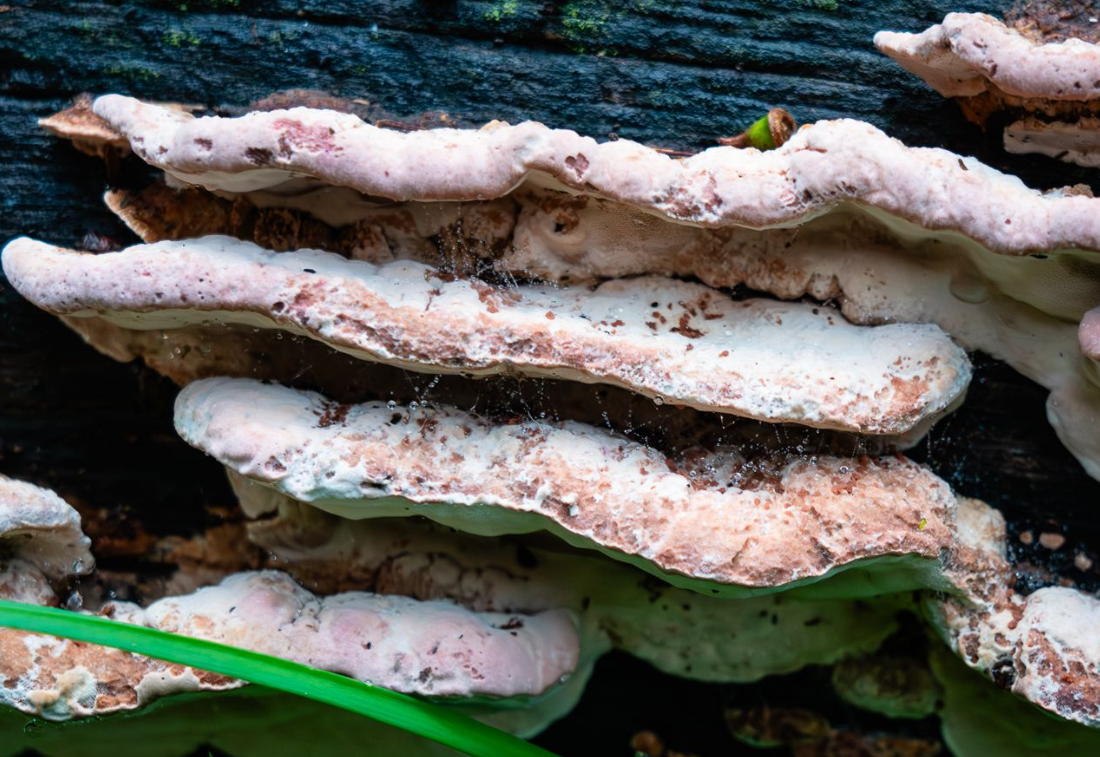
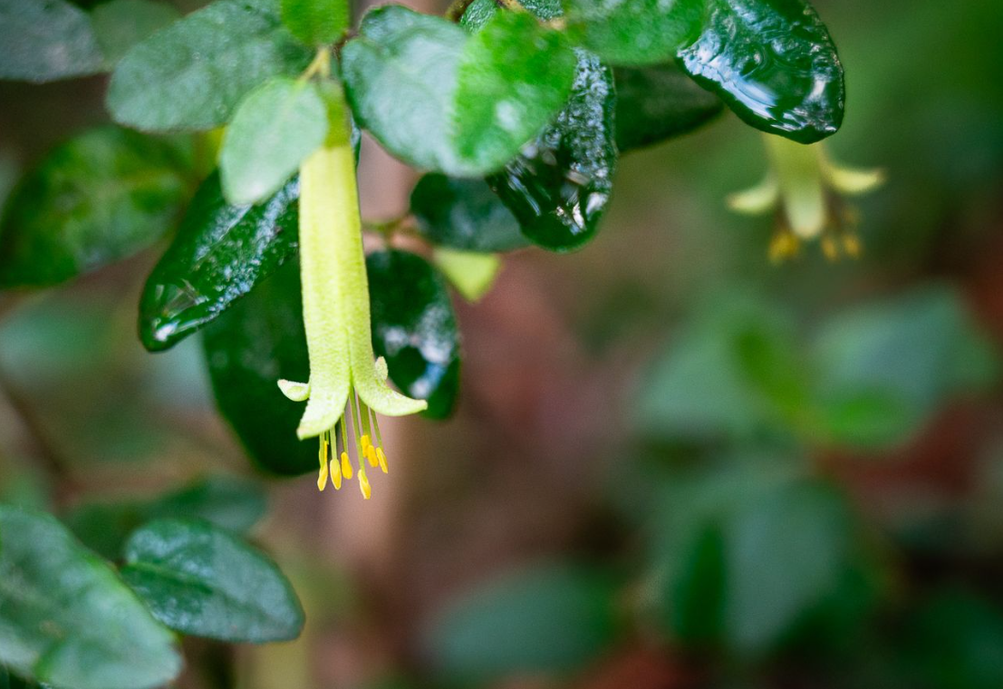
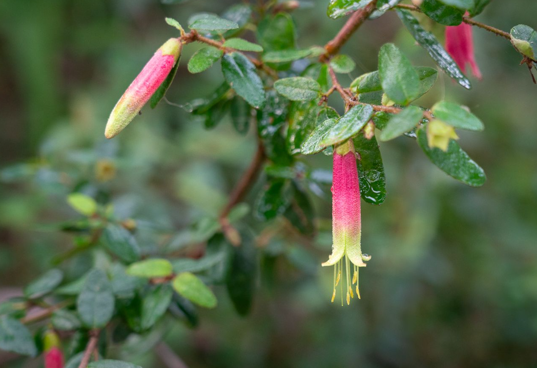
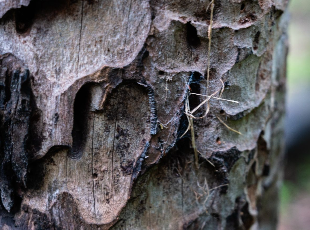
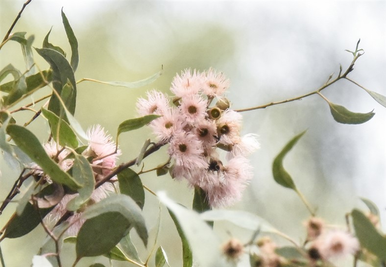
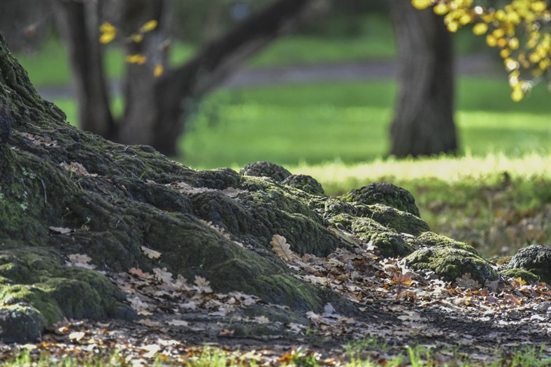
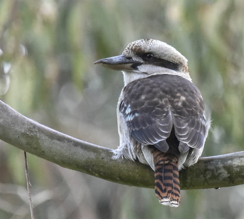
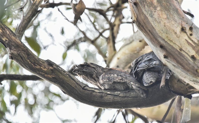
Sightings
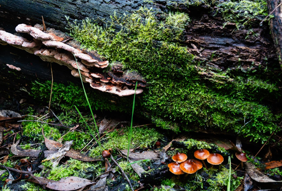
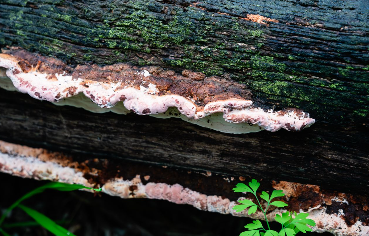
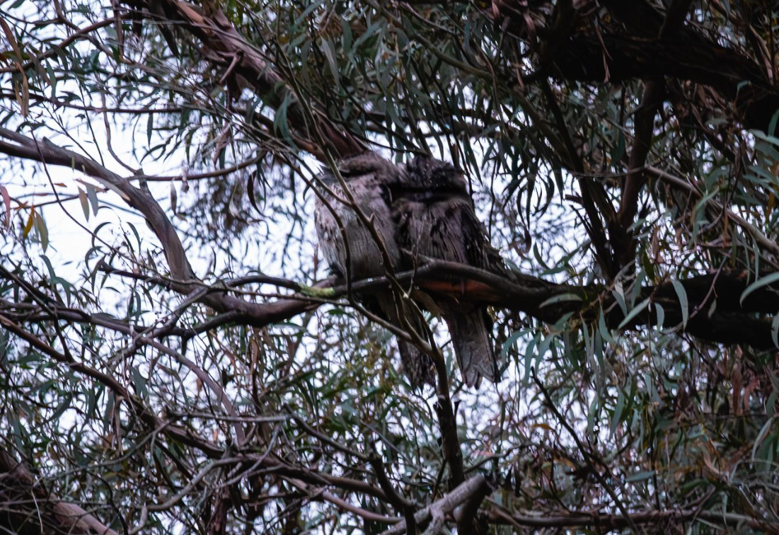
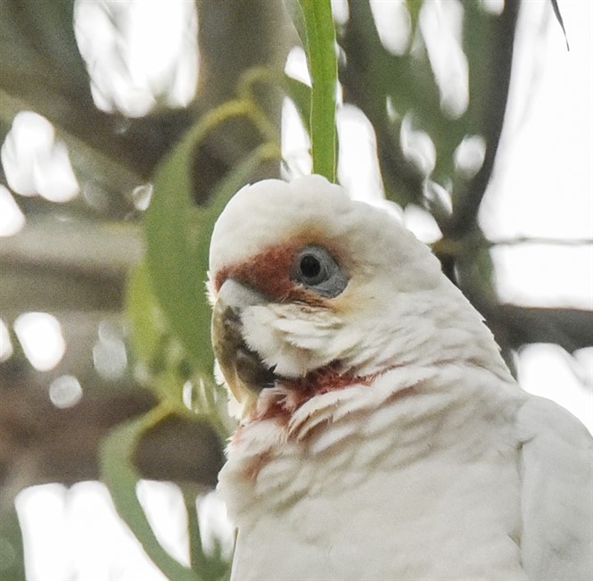
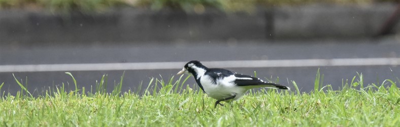
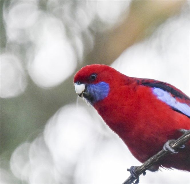
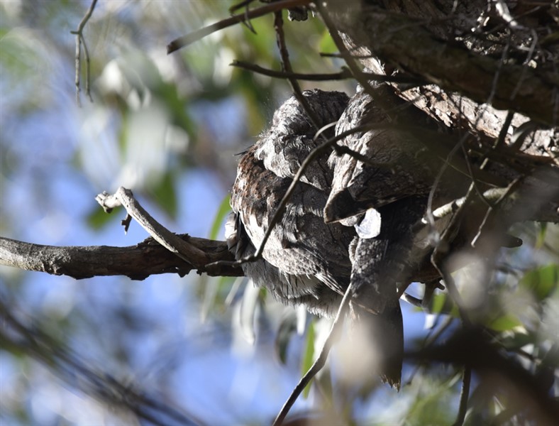
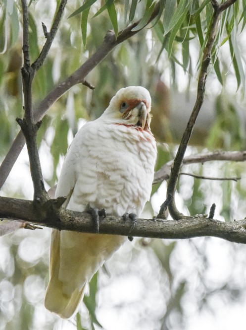
Our thanks to Liz Reen for the first 7 photos below showing a study of a fungus, native fuchsias, an isodontic wasp nest and some cold-looking Tawny Frogmouths in Blacks Walk on 9th June. The remainder show bird-life and other sightings in Kalang and Furness Parks taken on 12th June
Liz also exposes a controversial aspect of the park’s plants – the two Native Fuschias she has photographed are actually the same species: Correa reflexa. Interestingly, it has both a green form and a red form – the indigenous plant nurseries and (probably) the Council nursery grow both. Historically, we have only planted the green form because it was thought to be the version indigenous to our local area. However, Council sometimes plants the red form in the park and it is known to be indigenous to Nunawading (ie close by).
Other photos include a Long-billed Corella, a female Mudlark, Crimson Rosella, Rainbow Lorikeet, Pacific Black Duck, King-parrot, Kookaburra, more Tawny Frogmouths, eucalypt flowers and old Oak roots.
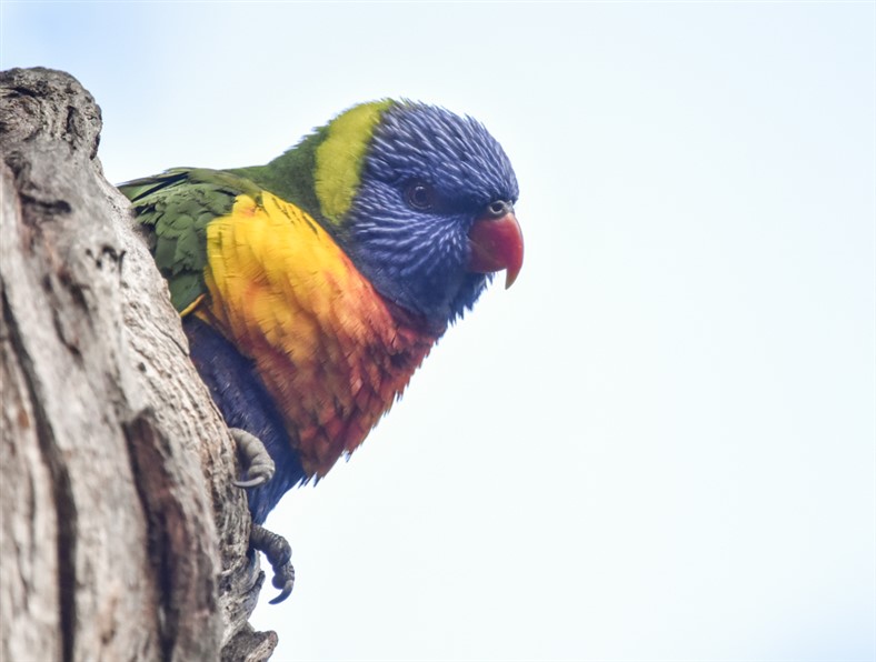
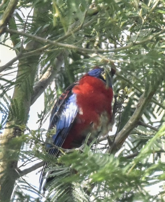
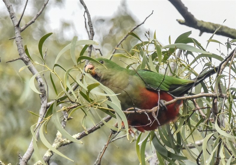
Please click on image to enlarge; click on the X to return
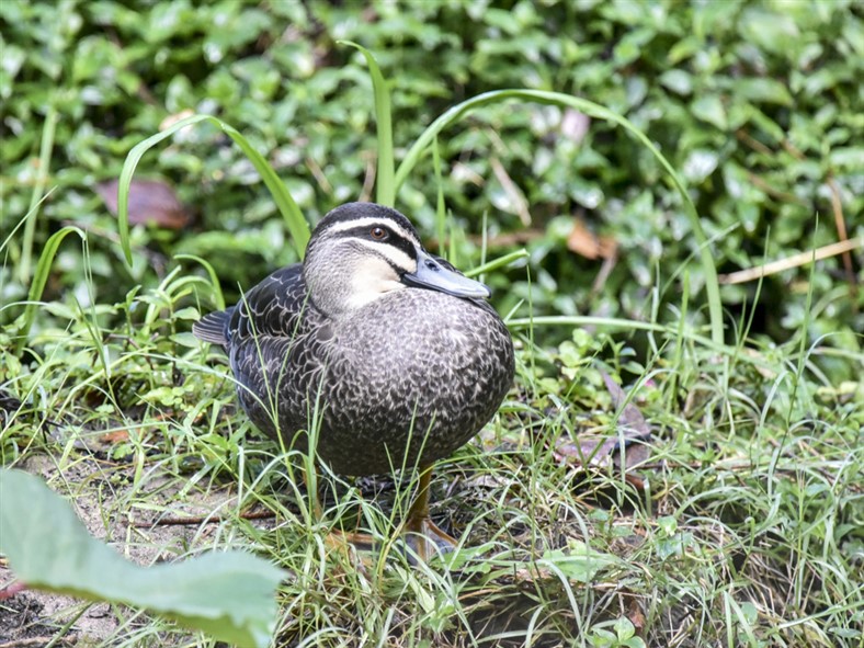
Do ducks need to take a bath ?
Ducks spend a lot of time in “on water matters” feeding and so forth. So, do they need to take a bath? Luckily, one of our reporters was out and about and has an answer for us courtesy of one of our Chestnut Teals:
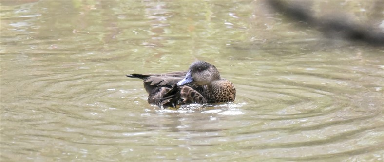
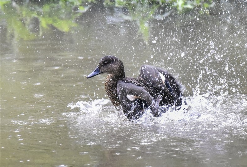
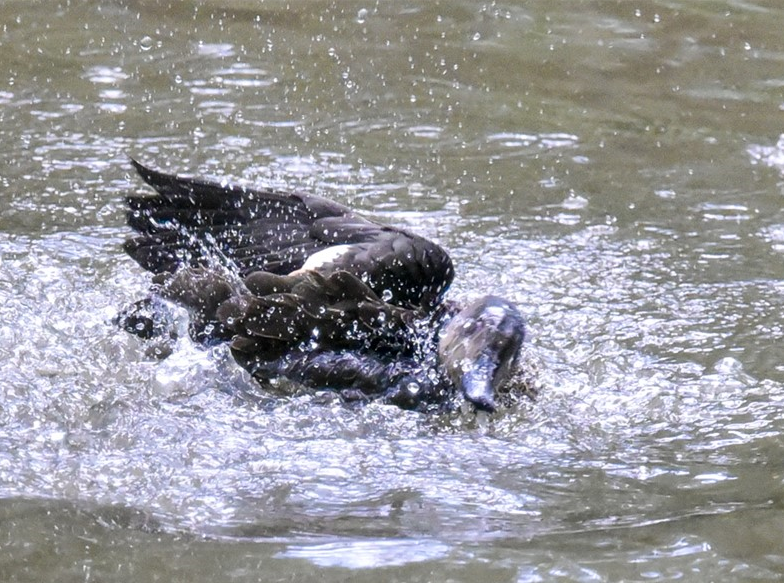
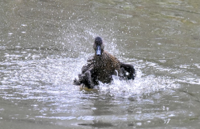
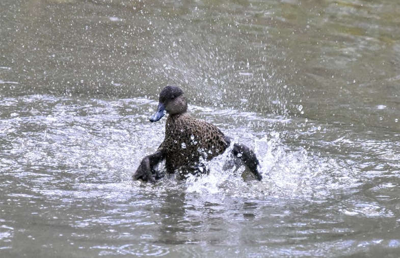
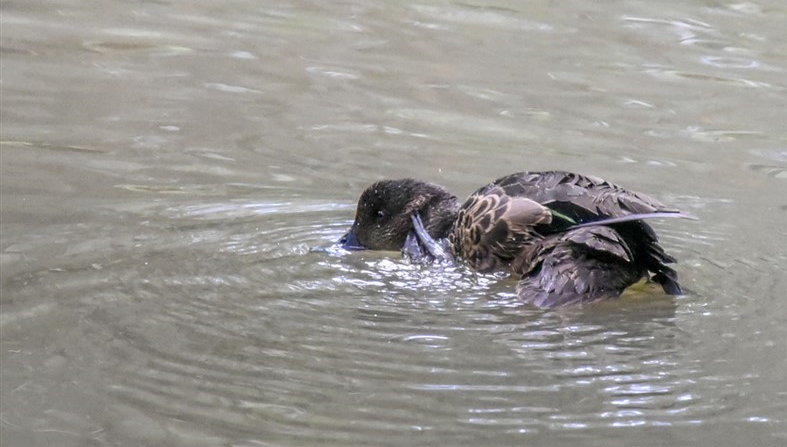
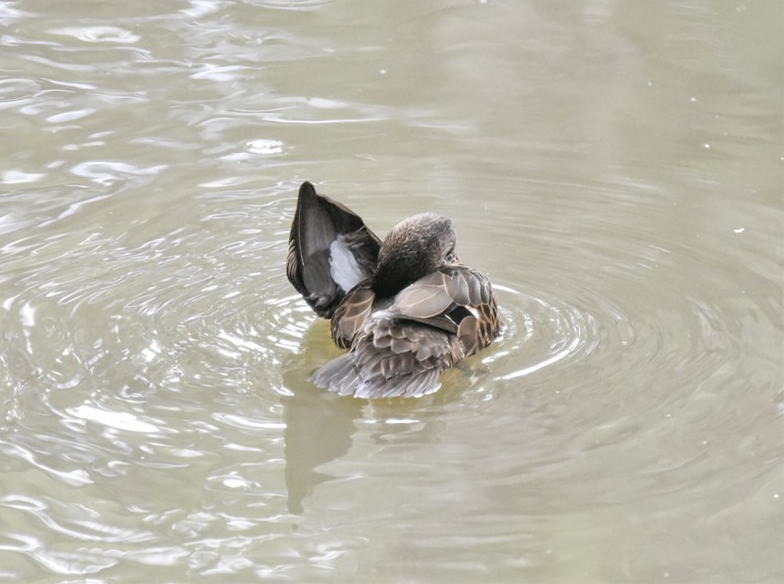
Please click on image to enlarge; click on the X to return
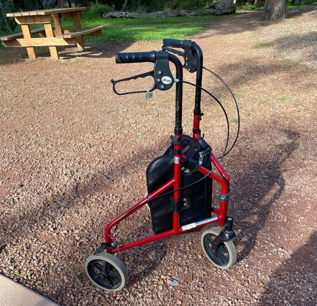
Lost Walker
Equipment – not a person, we trust! This walker was left in Blacks Walk near the children’s playground for several days – a local has secured it at his home. If it is yours, please let us know and we’ll make arrangements to reunite you with your property.

Pingback: Thursday Team Plan for 11/7/2024 | The Blackburn Creeklands