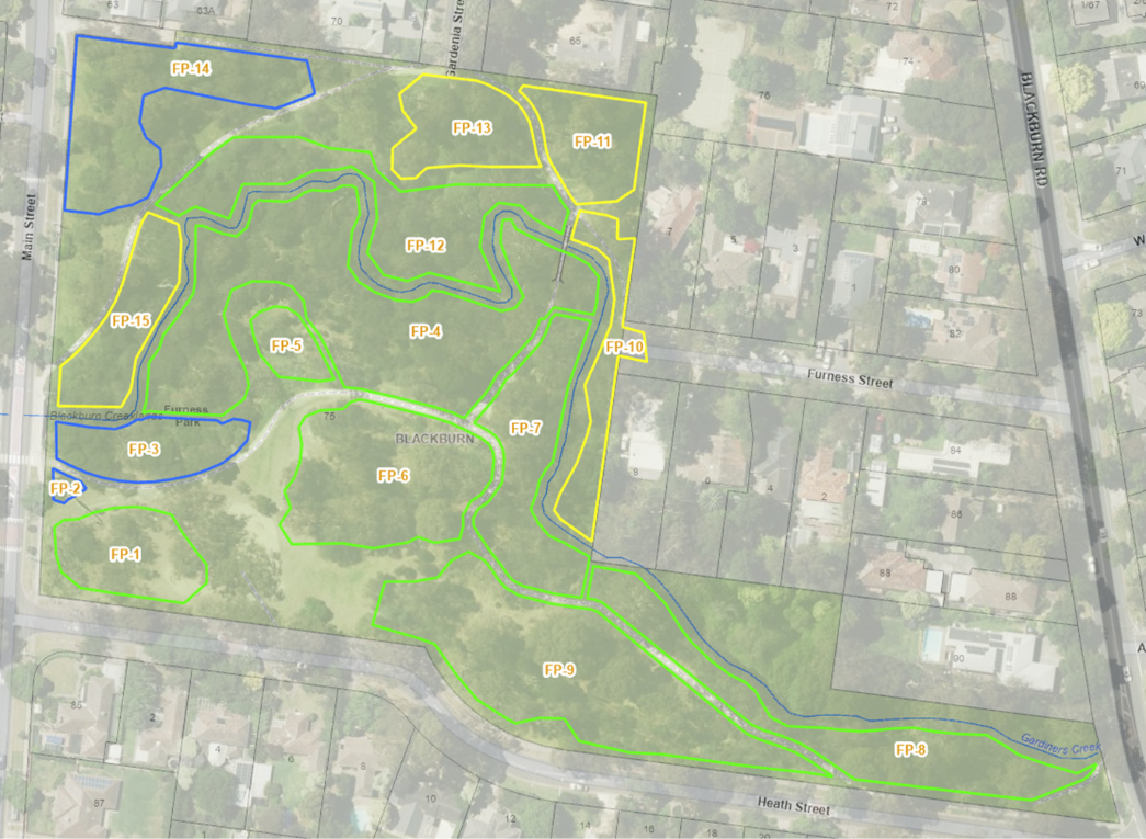
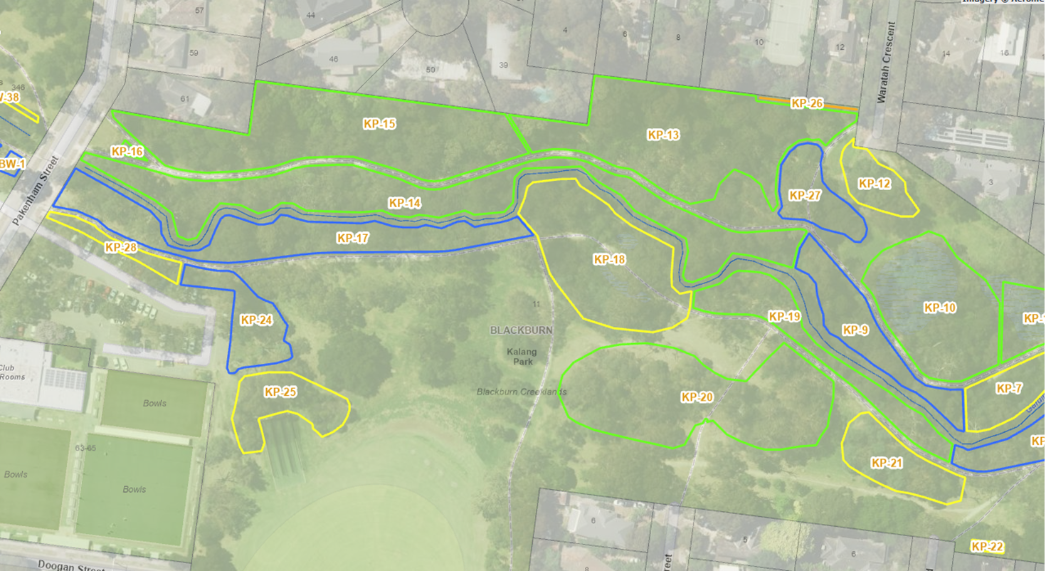
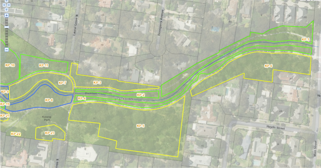
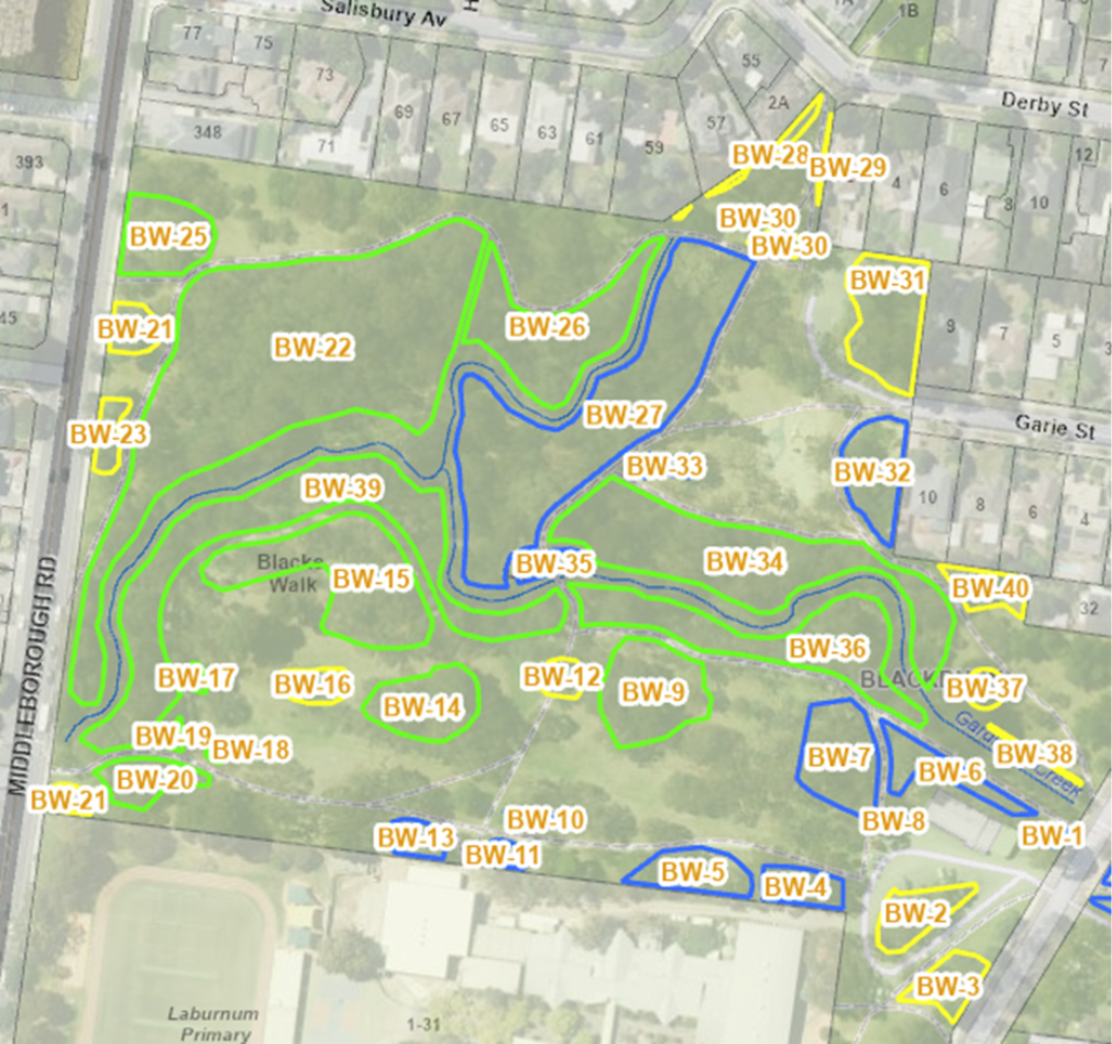
- From 2019, Council began sharing its maps of park maintenance areas with Committee and other workers on the ground. This has meant improved communications between the groups in that Council (highlighted in yellow), its contractors (highlighted in green) and Committee (highlighted in blue) all use the same references for maintenance areas in the park.
- These maps are as follows (click on map to enlarge):
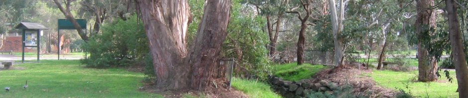
Furness Park
Kalang Park west (top) and east (bottom)
Blacks Walk
Blocks (Superseded)
- The management areas of the Blackburn Creeklands parks were formerly referred to as Blocks and are referenced by the park name (F=Furness Park, K=Kalang Park, B=Blacks Walk) then N=North of Creek, S=South of Creek and then a block number.
- For example: FS 1 denotes Block 1, Furness Park, south of the creek.
- We refer to the creek and its banks separately because the they have quite separate characteristics to the adjacent parkland. Most land areas typically run up to the top of the creek bank but do not include the creek and its banks. The area along the creek is given the same number as adjacent blocks but with a ‘C’ added.
- For example: FS 1C denotes the creek itself or creek bank next to Block 1, Furness Park, south of the creek.
- Here are three maps which show the updated maintenance block numbers.
- All in all, there are almost 80 blocks referred to by the Advisory Committee. These are listed here.
